Air Ambulance Helicopter to Nottingham Heliport, Nottingham Heliport
Wednesday, 18 February 2026 | 13:31 | From Danesmoor
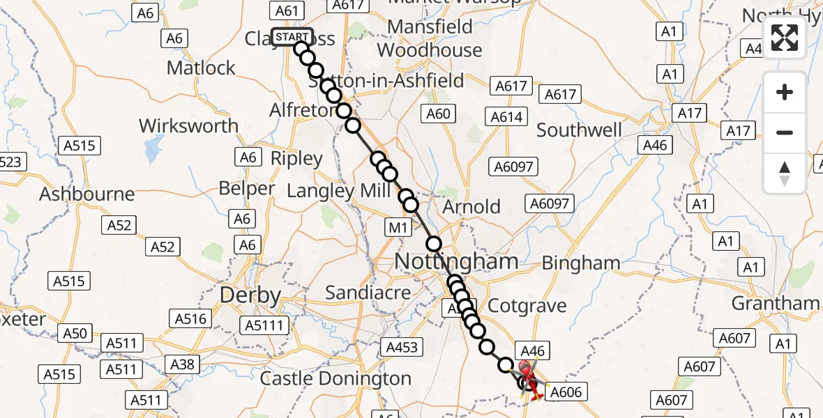
On Wednesday, 18 February 2026 at 13:31, a Air Ambulance Helicopter departed from Danesmoor to Nottingham Heliport. It was the Air Ambulance Helicopter with registration number G-DRLA. The flight lasted 13 minutes. During that period, the aircraft travelled 28 miles at an average speed of 131 miles per hour at a maximum altitude of 1525 feet.
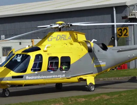
Helicopter: G-DRLA
The helicopter G-DRLA is used as an ambulance helicopter. The helicopter is equipped with a stretcher for transporting patients. The helicopter is often used to transport to hospitals.
Photo: Alec Wilson
29 miles
1525 feet
131 mph
14 minutes
13:31
13:45

Route
Nottingham Heliport, 13:45
Nottingham Heliport13:44
Willoughby on the Wolds, Rushcliffe13:44
Widmerpool, Rushcliffe13:43
Keyworth, Rushcliffe13:42
Bradmore, Rushcliffe13:41
Ruddington, Rushcliffe13:41
Rushcliffe, East Midlands13:41
West Bridgford, Rushcliffe13:41
West Bridgford, City of Nottingham13:40
West Bridgford, Rushcliffe13:40
Wilford, West Bridgford13:40
City of Nottingham, East Midlands13:39
Bulwell, City of Nottingham13:37
Hucknall, Ashfield13:37
Greasley, Broxtowe13:36
Watnall, Ashfield13:36
Underwood, Ashfield13:36
Selston CP, Ashfield13:35
Pinxton, Bolsover13:34
South Normanton, Bolsover13:34
Blackwell, Bolsover13:33
Tibshelf, Bolsover13:33
Morton CP, North East Derbyshire13:32
Danesmoor, North East Derbyshire13:32
Bridge Street, Clay Cross CP13:31
Live flights
Today
Flights Danesmoor
Helicopter flights on your website?
You can easily display helicopter flights on your own website. Use the embed code.
