Air Ambulance Helicopter to Coventry Airport, Coventry Airport
Wednesday, 18 February 2026 | 13:14 | From Ansley CP
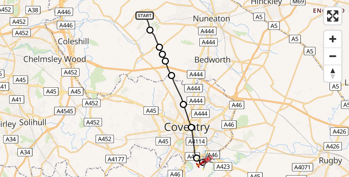
On Wednesday, 18 February 2026 at 13:14, a Air Ambulance Helicopter departed from Ansley CP to Coventry Airport. It was the Air Ambulance Helicopter with registration number G-WNAS. The flight lasted 6 minutes. During that period, the aircraft travelled 12 miles at an average speed of 116 miles per hour at a maximum altitude of 1725 feet.
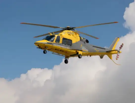
Helicopter: G-WNAS
The helicopter G-WNAS is used as an ambulance helicopter. The helicopter is equipped with a stretcher for transporting patients. The helicopter is often used to transport to hospitals.
Photo: Tony Melony
12 miles
1725 feet
116 mph
7 minutes
13:14
13:20

Route
Coventry Airport, Coventry, West Midlands13:20
Coventry Airport, Coventry, West Midlands13:20
Baginton, Warwick13:19
Coventry, West Midlands13:18
Daimler Green, Coventry13:17
Coventry, West Midlands13:16
Corley, North Warwickshire13:16
North Warwickshire13:16
Wood End, North Warwickshire13:15
New Arley, North Warwickshire13:15
Mill Lane, North Warwickshire13:14
Live flights
Today
Helicopter flights on your website?
You can easily display helicopter flights on your own website. Use the embed code.
