Air Ambulance Helicopter to Hill Croome, Baughton Lane
Wednesday, 18 February 2026 | 11:55 | From Mickleton
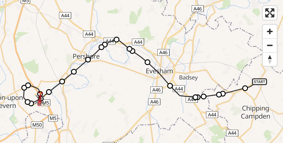
On Wednesday, 18 February 2026 at 11:55, a Air Ambulance Helicopter departed from Mickleton to Hill Croome. It was the Air Ambulance Helicopter with registration number G-OMAA. The flight lasted 12 minutes. During that period, the aircraft travelled 24 miles at an average speed of 118 miles per hour at a maximum altitude of 1650 feet.
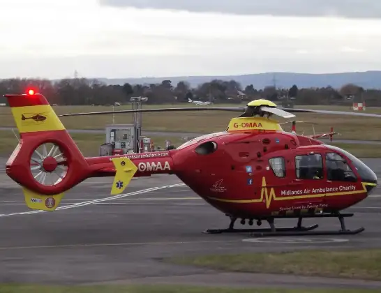
Helicopter: G-OMAA
The helicopter G-OMAA is used as a air ambulance helicopter. The main purpose of this aircraft is to transport a Mobile Medical Team to an incident as quickly as possible, enabling the trauma doctor to provide immediate first aid on site. The aircraft is flying this flight as Air Ambulance Helicopter.
Photo: James from Cheltenham, Gloucestershire
24 miles
1650 feet
118 mph
13 minutes
11:55
12:07

Route
Hill Croome, Malvern Hills12:07
Baughton Lane, Malvern Hills12:06
Earl's Croome, Malvern Hills12:05
Hill Croome, Malvern Hills12:05
Ripple, Malvern Hills12:04
Upper Strensham, Wychavon12:04
Hill Croome, Malvern Hills12:04
Upper Strensham, Wychavon12:03
Defford, Wychavon12:03
Pensham, Wychavon12:02
Pensham, Pershore12:02
Wick, Wychavon12:01
Wyre Piddle, Wychavon12:01
Lower Moor, Wychavon12:00
Fladbury, Wychavon12:00
Cropthorne, Wychavon11:59
Charlton, Wychavon11:59
Evesham, Wychavon11:58
Wickhamford, Wychavon11:57
Broadway, Wychavon11:57
Willersey, Cotswold11:57
Cotswold11:56
Honeybourne, Wychavon11:56
Weston-sub-Edge, Cotswold11:56
B4632, Cotswold11:55
Mickleton, Cotswold11:55
Live flights
Today
Police Helicopter to Manchester Barton Aerodrome13 Jul 23:56
Police Helicopter to Bournemouth Airport13 Jul 23:55
Air Ambulance Helicopter to Cardiff Heliport13 Jul 23:38
Police Helicopter to Birmingham Airport13 Jul 23:21
Police Helicopter to Irlam, Twelve Yards Road13 Jul 23:00
Flights Mickleton
Police Helicopter to Mickleton18 Apr 14:50
Helicopter flights on your website?
You can easily display helicopter flights on your own website. Use the embed code.
