Air Ambulance Helicopter to Sherborne, Castle Town Way
Tuesday, 17 February 2026 | 21:45 | From Henstridge Airfield
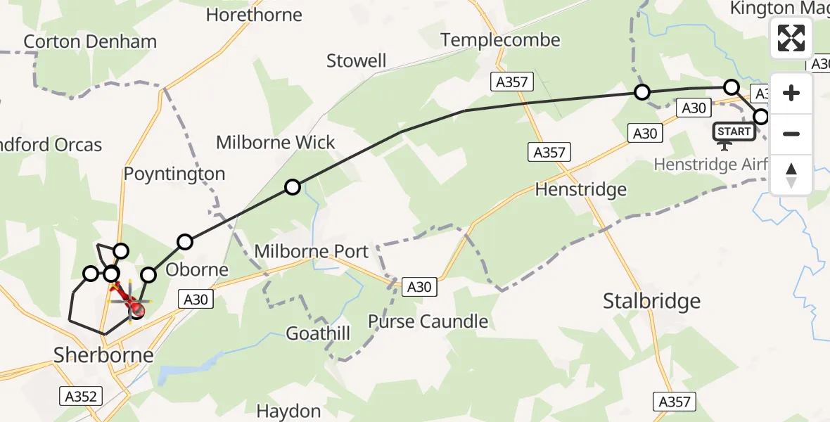
On Tuesday, 17 February 2026 at 21:45, a Air Ambulance Helicopter departed from Henstridge Airfield to Sherborne. It was the Air Ambulance Helicopter with registration number G-DSAA. The flight lasted 7 minutes. During that period, the aircraft travelled 11 miles at an average speed of 97 miles per hour at a maximum altitude of 1225 feet.
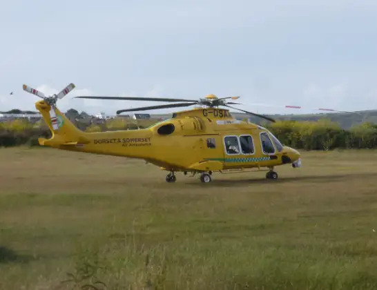
Helicopter: G-DSAA
The helicopter G-DSAA is used as a air ambulance helicopter. The main purpose of this aircraft is to transport a Mobile Medical Team to an incident as quickly as possible, enabling the trauma doctor to provide immediate first aid on site. The aircraft is flying this flight as Air Ambulance Helicopter.
Photo: Andrew Bone
12 miles
1225 feet
97 mph
7 minutes
21:45
21:52

Route
Castle Town Way, 21:52
Sherborne21:51
Castleton21:50
Sherborne21:50
Castleton21:50
Sherborne21:49
Castleton21:49
Oborne21:48
Milborne Wick21:48
Henstridge21:46
Kington Magna21:46
Henstridge21:45
Henstridge Airfield, Templecombe, Somerset21:45
Today
Flights Sherborne
Police Helicopter to Bournemouth Airport25 May 19:25
Police Helicopter to Sherborne, Kings Road25 May 19:06
Air Ambulance Helicopter to Henstridge Airfield18 Mar 15:39
Air Ambulance Helicopter to Sherborne, A3018 Mar 14:50
Air Ambulance Helicopter to Henstridge Airfield17 Feb 22:32
Air Ambulance Helicopter to Henstridge Airfield14 Feb 01:33
Helicopter flights on your website?
You can easily display helicopter flights on your own website. Use the embed code.
