Air Ambulance Helicopter to Derby, Harrison Street
Tuesday, 17 February 2026 | 14:58 | From Upper Hartshay
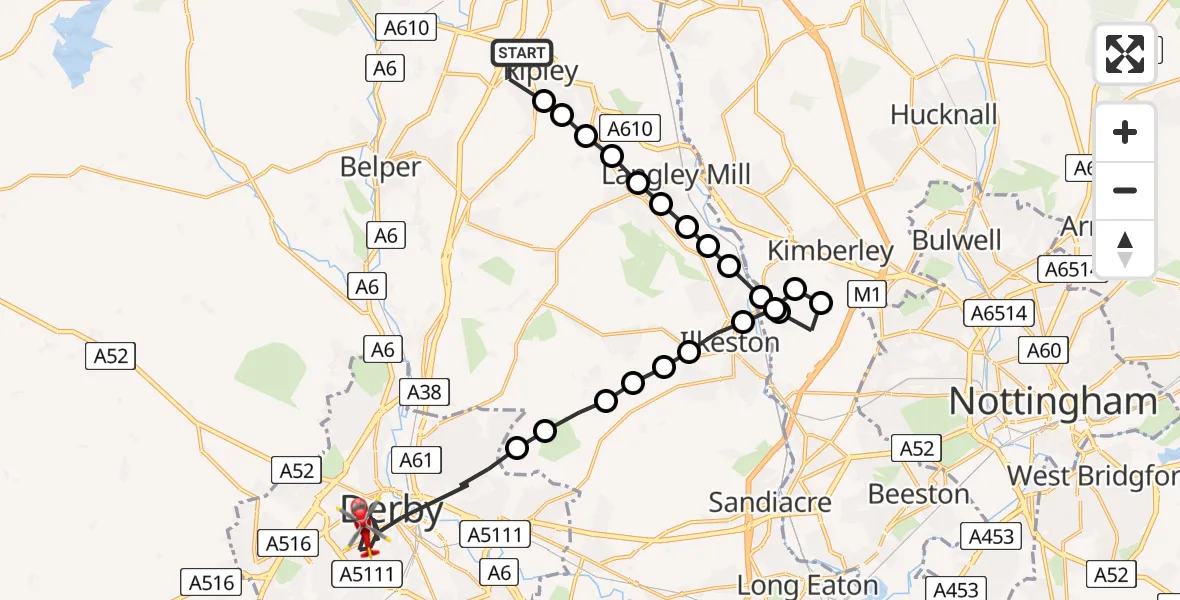
On Tuesday, 17 February 2026 at 14:58, a Air Ambulance Helicopter departed from Upper Hartshay to Derby. It was the Air Ambulance Helicopter with registration number G-DRLA. The flight lasted 10 minutes. During that period, the aircraft travelled 22 miles at an average speed of 139 miles per hour at a maximum altitude of 1350 feet.
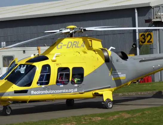
Helicopter: G-DRLA
The helicopter G-DRLA is used as an ambulance helicopter. The helicopter is equipped with a stretcher for transporting patients. The helicopter is often used to transport to hospitals.
Photo: Alec Wilson
23 miles
1350 feet
139 mph
10 minutes
14:58
15:07

Route
Harrison Street, East Midlands15:07
Derby, East Midlands15:04
Dale Abbey, Erewash15:04
Stanley, Erewash15:03
Dale Abbey, Erewash15:03
West Hallam, Erewash15:03
Kirk Hallam, Erewash15:03
Ilkeston, Erewash15:02
Cossall, Broxtowe15:02
Kimberley, Broxtowe15:02
Kimberley, City of Nottingham15:01
Cossall, Broxtowe15:01
Cossall, City of Nottingham15:01
Ilkeston, Erewash15:00
Shipley, Heanor15:00
Shipley, Amber Valley15:00
Marlpool, Amber Valley15:00
Heanor, Amber Valley14:59
Loscoe, Amber Valley14:59
Codnor CP, Amber Valley14:59
Waingroves, Ripley14:59
Marehay, Ripley14:58
Ripley Bypass, Ripley14:58
Today
Police Helicopter to Epping Forest, Green Lane26 Feb 23:43
Flights Derby
Air Ambulance Helicopter to Derby, Olive Street20 Feb 15:32
Air Ambulance Helicopter to Derby, Vernongate20 Feb 14:21
Helicopter flights on your website?
You can easily display helicopter flights on your own website. Use the embed code.
