Coastguard Helicopter to Penrhos Garnedd, Penrhos Road
Tuesday, 17 February 2026 | 14:39 | From Llandygai
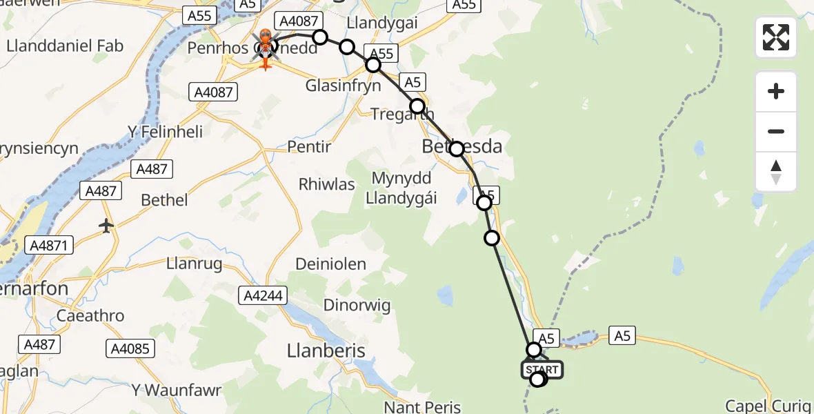
On Tuesday, 17 February 2026 at 14:39, a Coastguard Helicopter departed from Llandygai to Penrhos Garnedd. It was the Coastguard Helicopter with registration number G-MCGZ. The flight lasted 15 minutes. During that period, the aircraft travelled 12 miles at an average speed of 51 miles per hour at a maximum altitude of 1925 feet.
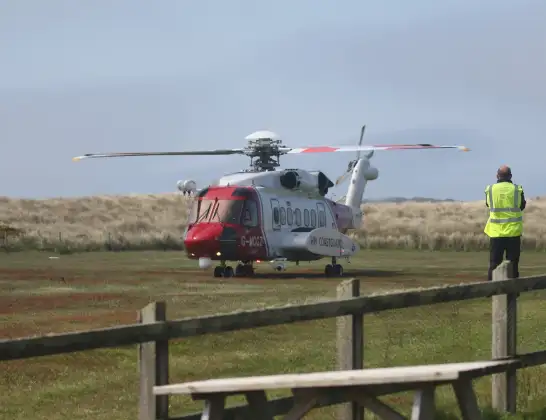
Helicopter: G-MCGZ
The helicopter G-MCGZ is used by the British Coastguard. The helicopter is deployed in search and rescue operations at sea, rescue operations involving ships or drilling platforms, patrols to prevent smuggling or piracy, environmental monitoring and disaster relief support.
Photo: Andrewrabbott
13 miles
1925 feet
51 mph
15 minutes
14:39
14:53

Route
Penrhos Garnedd14:53
Penrhos Road, 14:53
Ysbyty Gwynedd Hospital Heliport14:53
Penrhos Garnedd14:52
Bangor14:51
Glasinfryn14:51
Llandygai14:51
Tregarth14:50
Bethesda14:50
Braichmelyn14:49
Bethesda14:49
Capel Curig14:48
Llandygai14:41
Capel Curig14:40
Llwybr y Carw, 14:39
Live flights
Today
Police Helicopter to Falkirk02:12:08
Flights Llandygai
Coastguard Helicopter to Caernarfon Airport27 Jun 16:01
Coastguard Helicopter to Llandygai27 Jun 15:06
Coastguard Helicopter to Llandygai, A526 Jun 15:15
Coastguard Helicopter to Llandygai, Llanberis26 Jun 11:26
Coastguard Helicopter to Llandygai, A526 Jun 08:44
Coastguard Helicopter to Llandygai17 Feb 14:01
Helicopter flights on your website?
You can easily display helicopter flights on your own website. Use the embed code.
