Air Ambulance Helicopter to Coventry Airport
Tuesday, 17 February 2026 | 14:16 | From Whetstone
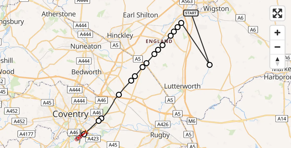
On Tuesday, 17 February 2026 at 14:16, a Air Ambulance Helicopter departed from Whetstone to Coventry Airport. It was the Air Ambulance Helicopter with registration number G-WNAS. The flight lasted 8 minutes. During that period, the aircraft travelled 30 miles at an average speed of 222 miles per hour at a maximum altitude of 1250 feet.
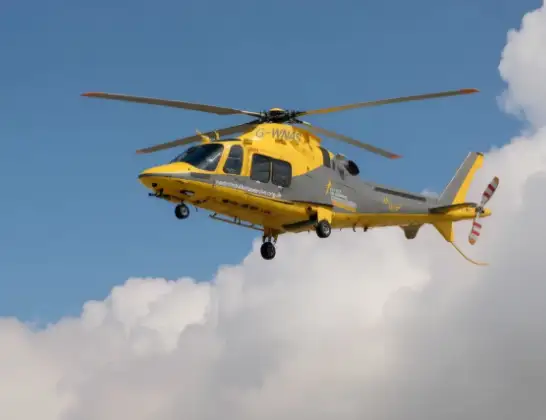
Helicopter: G-WNAS
The helicopter G-WNAS is used as an ambulance helicopter. The helicopter is equipped with a stretcher for transporting patients. The helicopter is often used to transport to hospitals.
Photo: Tony Melony
31 miles
1250 feet
222 mph
9 minutes
14:16
14:24

Route
Coventry Airport, Coventry, West Midlands14:24
Coventry Airport, Coventry, West Midlands14:24
Coventry, West Midlands14:22
Binley Woods CP, Rugby14:22
Rugby14:21
Withybrook CP, Rugby14:20
Wolvey CP, Rugby14:20
Rugby14:19
Claybrooke Magna, Harborough14:19
Claybrooke Farm Airstrip14:18
Frolesworth, Harborough14:18
Harborough14:18
Broughton Astley, Harborough14:17
Harborough14:17
Cosby14:17
Narborough14:17
Bruntingthorpe Aerodrome, Lutterworth, Leicestershire14:16
Woodyard Lane, 14:16
Live flights
Police Helicopter on its way from Ewelme13 Jul 22:24
Today
Police Helicopter to Bournemouth Airport13 Jul 23:55
Air Ambulance Helicopter to Cardiff Heliport13 Jul 23:38
Police Helicopter to Birmingham Airport13 Jul 23:21
Police Helicopter to Irlam, Twelve Yards Road13 Jul 23:00
Flights Whetstone
Police Helicopter to Whetstone, East Avenue2 Jul 13:22
Air Ambulance Helicopter to Nottingham Heliport25 Feb 12:42
Air Ambulance Helicopter to Coventry Airport17 Feb 14:16
Helicopter flights on your website?
You can easily display helicopter flights on your own website. Use the embed code.
