Air Ambulance Helicopter to Morecambe, Benson Avenue
Tuesday, 17 February 2026 | 12:24 | From Blackpool Airport
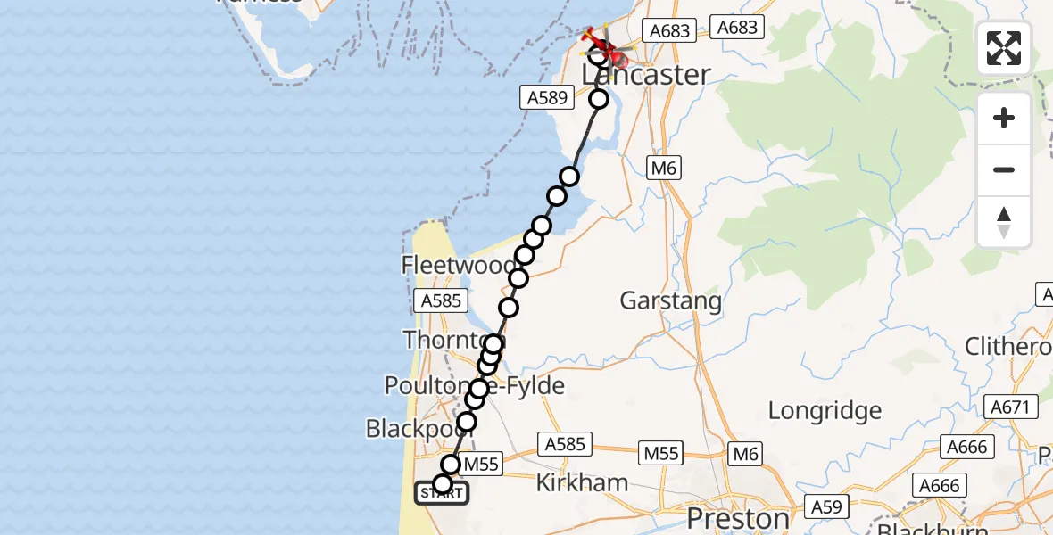
On Tuesday, 17 February 2026 at 12:24, a Air Ambulance Helicopter departed from Blackpool Airport to Morecambe. It was the Air Ambulance Helicopter with registration number G-NWAA. The flight lasted 12 minutes. During that period, the aircraft travelled 24 miles at an average speed of 115 miles per hour at a maximum altitude of 1125 feet.
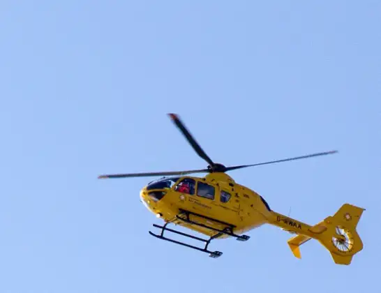
Helicopter: G-NWAA
The helicopter G-NWAA is used as a air ambulance helicopter. The main purpose of this aircraft is to transport a Mobile Medical Team to an incident as quickly as possible, enabling the trauma doctor to provide immediate first aid on site. The aircraft is flying this flight as Air Ambulance Helicopter.
Photo: David P Howard
24 miles
1125 feet
115 mph
13 minutes
12:24
12:36

Route
Benson Avenue, Lancaster12:36
Morecambe, Lancaster12:35
Lancaster, Lancashire12:35
Morecambe, Lancaster12:34
Lancaster, Lancashire12:33
Overton, Lancaster12:31
Lancaster, Lancashire12:31
Wyre, Lancashire12:30
Pilling, Wyre12:30
Wyre, Lancashire12:29
Preesall, Wyre12:29
Stalmine, Wyre12:28
Hambleton, Wyre12:27
Little Thornton, Wyre12:27
Fylde, Lancashire12:27
Poulton-le-Fylde, Wyre12:26
Hardhorn, Wyre12:26
Staining, Fylde12:26
Blackpool, Lancashire12:25
Common Edge, Lancashire12:24
Amy Johnson Way, Lancashire12:24
Live flights
Police Helicopter on its way from Ewelme13 Jul 22:24
Today
Police Helicopter to Manchester Barton Aerodrome13 Jul 23:56
Police Helicopter to Bournemouth Airport13 Jul 23:55
Air Ambulance Helicopter to Cardiff Heliport13 Jul 23:38
Police Helicopter to Birmingham Airport13 Jul 23:21
Police Helicopter to Irlam, Twelve Yards Road13 Jul 23:00
Flights Morecambe
Air Ambulance Helicopter to Morecambe, Broadway10 Jul 08:37
Air Ambulance Helicopter to Blackpool Airport28 Jun 14:41
Air Ambulance Helicopter to Lancaster General26 May 16:41
Air Ambulance Helicopter to Blackpool Airport17 Feb 13:15
Helicopter flights on your website?
You can easily display helicopter flights on your own website. Use the embed code.
