Air Ambulance Helicopter to Guisborough, Waterfall Farm roundabout
Tuesday, 17 February 2026 | 12:12 | From Egglescliffe
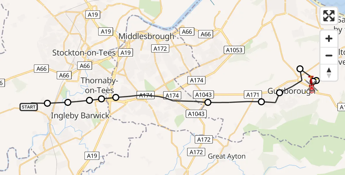
On Tuesday, 17 February 2026 at 12:12, a Air Ambulance Helicopter departed from Egglescliffe to Guisborough. It was the Air Ambulance Helicopter with registration number G-NHAE. The flight lasted 7 minutes. During that period, the aircraft travelled 16 miles at an average speed of 146 miles per hour at a maximum altitude of 1575 feet.
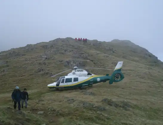
Helicopter: G-NHAE
The helicopter G-NHAE is used as a air ambulance helicopter. The main purpose of this aircraft is to transport a Mobile Medical Team to an incident as quickly as possible, enabling the trauma doctor to provide immediate first aid on site. The aircraft is flying this flight as Air Ambulance Helicopter.
Photo: Michael Earnshaw
17 miles
1575 feet
146 mph
7 minutes
12:12
12:18

Route
Waterfall Farm roundabout, Tees Valley12:18
Guisborough, Tees Valley12:18
Skelton and Brotton, Tees Valley12:18
Upleatham, Guisborough12:18
Guisborough, Tees Valley12:17
Hutton Village, Guisborough12:17
Guisborough, Tees Valley12:16
Middlesbrough, Tees Valley12:14
Thornaby-on-Tees, Tees Valley12:14
RAF Thornaby, Stockton-on-Tees, North Yorkshire12:13
Ingleby Barwick, Tees Valley12:13
Eaglescliffe, Tees Valley12:12
Egglescliffe, Tees Valley12:12
Live flights
Today
Police Helicopter to Manchester Barton Aerodrome13 Jul 23:56
Police Helicopter to Bournemouth Airport13 Jul 23:55
Air Ambulance Helicopter to Cardiff Heliport13 Jul 23:38
Police Helicopter to Harborough, Sulby Road13 Jul 23:36
Police Helicopter to Birmingham Airport13 Jul 23:21
Flights Guisborough
Flights Egglescliffe
Air Ambulance Helicopter to Egglescliffe, A6713 Jul 15:39
Air Ambulance Helicopter to Egglescliffe, A6713 Jul 13:57
Air Ambulance Helicopter to Egglescliffe10 Jul 15:36
Helicopter flights on your website?
You can easily display helicopter flights on your own website. Use the embed code.
