Air Ambulance Helicopter to Henstridge Airfield
Tuesday, 17 February 2026 | 10:56 | From Southwell
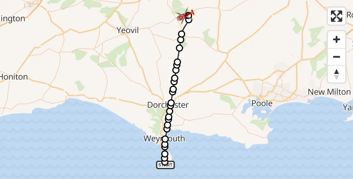
On Tuesday, 17 February 2026 at 10:56, a Air Ambulance Helicopter departed from Southwell to Henstridge Airfield. It was the Air Ambulance Helicopter with registration number G-DSAA. The flight lasted 15 minutes. During that period, the aircraft travelled 33 miles at an average speed of 129 miles per hour at a maximum altitude of 1300 feet.
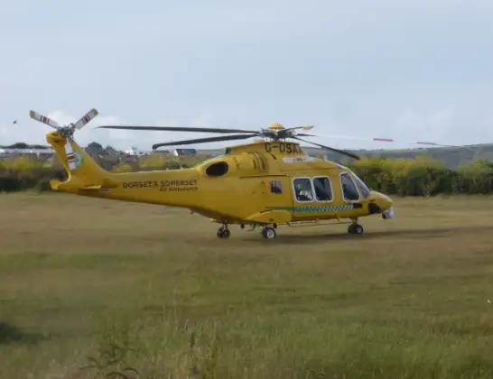
Helicopter: G-DSAA
The helicopter G-DSAA is used as a air ambulance helicopter. The main purpose of this aircraft is to transport a Mobile Medical Team to an incident as quickly as possible, enabling the trauma doctor to provide immediate first aid on site. The aircraft is flying this flight as Air Ambulance Helicopter.
Photo: Andrew Bone
33 miles
1300 feet
129 mph
16 minutes
10:56
11:12

Route
Henstridge Airfield, Templecombe, Somerset11:12
Fifehead Magdalen11:11
Marnhull11:11
Stalbridge11:09
Lydlinch11:09
King's Stag11:08
Mappowder11:07
Piddletrenthide11:07
Plush11:06
Piddletrenthide11:05
White Lackington11:05
Piddlehinton11:04
Athelhampton and Puddletown11:04
Stinsford11:03
Dorchester11:03
Winterborne Herringston11:02
Winterborne Came11:02
Bincombe11:02
Preston11:01
Preston, Weymouth11:01
Weymouth11:00
Wyke Regis, Weymouth10:59
Castletown10:59
Chiswell10:58
Fortuneswell10:58
Weston10:57
Underhedge Gardens, 10:56
Today
Flights Southwell
Police Helicopter to Bournemouth Airport25 Apr 19:14
Police Helicopter to Southwell, Grangecroft Road24 Apr 17:44
Coastguard Helicopter to RNAS Portland Heliport24 Apr 13:53
Air Ambulance Helicopter to Henstridge Airfield17 Feb 10:56
Helicopter flights on your website?
You can easily display helicopter flights on your own website. Use the embed code.
