Air Ambulance Helicopter to Southwell, Underhedge Gardens
Tuesday, 17 February 2026 | 10:03 | From Henstridge Airfield
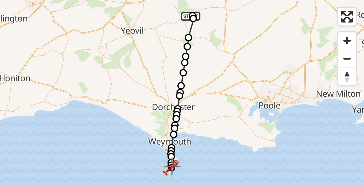
On Tuesday, 17 February 2026 at 10:03, a Air Ambulance Helicopter departed from Henstridge Airfield to Southwell. It was the Air Ambulance Helicopter with registration number G-DSAA. The flight lasted 16 minutes. During that period, the aircraft travelled 33 miles at an average speed of 127 miles per hour at a maximum altitude of 1300 feet.
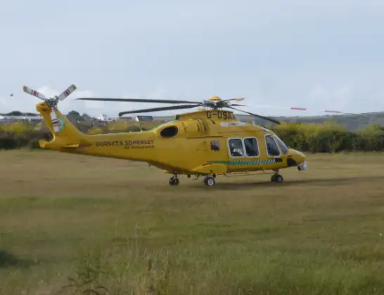
Helicopter: G-DSAA
The helicopter G-DSAA is used as a air ambulance helicopter. The main purpose of this aircraft is to transport a Mobile Medical Team to an incident as quickly as possible, enabling the trauma doctor to provide immediate first aid on site. The aircraft is flying this flight as Air Ambulance Helicopter.
Photo: Andrew Bone
34 miles
1300 feet
127 mph
16 minutes
10:03
10:18

Route
Underhedge Gardens, 10:18
Southwell10:17
Weston10:17
Easton10:16
Fortuneswell10:16
Chiswell10:15
English Channel10:15
Wyke Regis, Weymouth10:15
Weymouth10:14
Preston, Weymouth10:14
Preston10:13
Broadmayne10:13
West Stafford10:12
Winterborne Came10:12
Dorchester10:12
Stinsford10:11
Athelhampton and Puddletown10:11
Piddlehinton10:10
Piddletrenthide10:09
Plush10:08
Mappowder10:08
Hazelbury Bryan10:07
Lydlinch10:06
Stalbridge10:05
Kington Magna10:04
Henstridge Airfield, Templecombe, Somerset10:04
Henstridge Airfield, Templecombe, Somerset10:03
Today
Police Helicopter to Epping Forest, Green Lane26 Feb 23:43
Flights Southwell
Helicopter flights on your website?
You can easily display helicopter flights on your own website. Use the embed code.
