Air Ambulance Helicopter to Glascwm, Giants Grave Byway
Monday, 16 February 2026 | 14:03 | From Dafen
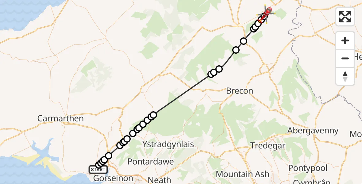
On Monday, 16 February 2026 at 14:03, a Air Ambulance Helicopter departed from Dafen to Glascwm. It was the Air Ambulance Helicopter with registration number G-WROL. The flight lasted 21 minutes. During that period, the aircraft travelled 50 miles at an average speed of 144 miles per hour at a maximum altitude of 2475 feet.
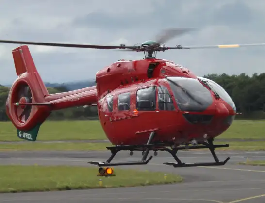
Helicopter: G-WROL
The helicopter G-WROL is used as a air ambulance helicopter. The main purpose of this aircraft is to transport a Mobile Medical Team to an incident as quickly as possible, enabling the trauma doctor to provide immediate first aid on site. The aircraft is flying this flight as Air Ambulance Helicopter.
Photo: James from Cheltenham, Gloucestershire
51 miles
2475 feet
144 mph
21 minutes
14:03
14:24

Route
Giants Grave Byway, 14:24
Glascwm14:24
Hundred House14:23
Glascwm14:23
Hundred House14:22
Aberedw14:22
Builth Wells14:21
Erwood14:20
Merthyr Cynog14:18
Trallong14:17
Llanfihangel Nant Brân14:17
Llangadog14:11
Brynaman14:11
Llangadog14:10
Cwarter Bach14:10
Cwmamman14:09
Cwmaman14:09
Glanamman14:08
Pontaman14:08
Betws14:07
Ammanford14:07
Pantyffynnon14:07
Llanedi14:05
Hendy14:05
Llanedi14:05
Llangennech14:04
Llanelli Rural14:04
Heol Llethri, 14:04
Dafen14:03
Today
Flights Glascwm
Flights Dafen
Air Ambulance Helicopter to Dafen, Heol Aur13 Jul 18:27
Air Ambulance Helicopter to Barry, Waycock Road13 Jul 14:28
Air Ambulance Helicopter to Dafen, Heol Aur13 Jul 12:46
Air Ambulance Helicopter to Cray13 Jul 10:03
Air Ambulance Helicopter to Dafen, Heol Aur12 Jul 16:00
Air Ambulance Helicopter to Nantmel, A4412 Jul 13:50
Air Ambulance Helicopter to Dafen, Heol Aur12 Jul 08:18
Air Ambulance Helicopter to Dafen, Heol Aur11 Jul 18:18
Air Ambulance Helicopter to Llywel11 Jul 15:17
Air Ambulance Helicopter to Dafen, Heol Aur11 Jul 11:03
Helicopter flights on your website?
You can easily display helicopter flights on your own website. Use the embed code.
