Air Ambulance Helicopter to Ainstable
Saturday, 14 February 2026 | 12:09 | From Skirwith
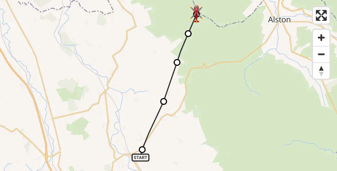
On Saturday, 14 February 2026 at 12:09, a Air Ambulance Helicopter departed from Skirwith to Ainstable. It was the Air Ambulance Helicopter with registration number G-NHAE. The flight lasted 4 minutes. During that period, the aircraft travelled 9 miles at an average speed of 142 miles per hour at a maximum altitude of 2725 feet.
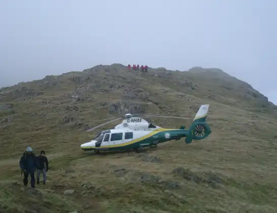
Helicopter: G-NHAE
The helicopter G-NHAE is used as a air ambulance helicopter. The main purpose of this aircraft is to transport a Mobile Medical Team to an incident as quickly as possible, enabling the trauma doctor to provide immediate first aid on site. The aircraft is flying this flight as Air Ambulance Helicopter.
Photo: Michael Earnshaw
10 miles
2725 feet
142 mph
4 minutes
12:09
12:13

Route
Ainstable, 12:13
Ainstable12:13
Kirkoswald12:12
Renwick12:11
Gamblesby12:10
A686, 12:10
Melmerby12:09
Skirwith12:09
Live flights
Today
Flights Ainstable
Air Ambulance Helicopter to Ainstable14 Feb 12:09
Flights Skirwith
Air Ambulance Helicopter to Milburn8 Jul 15:05
Air Ambulance Helicopter to Skirwith5 Jul 19:31
Air Ambulance Helicopter to Skirwith, B64124 Jul 20:31
Air Ambulance Helicopter to Skirwith1 Jul 09:53
Air Ambulance Helicopter to Skirwith25 Jun 08:28
Air Ambulance Helicopter to Allendale, The Peth20 Jun 13:47
Air Ambulance Helicopter to Skirwith18 Jun 13:47
Air Ambulance Helicopter to Skirwith, B641214 Jun 20:00
Air Ambulance Helicopter to Skirwith9 Jun 13:00
Helicopter flights on your website?
You can easily display helicopter flights on your own website. Use the embed code.
