Air Ambulance Helicopter to Lincoln, Monks Road
Saturday, 14 February 2026 | 10:30 | From Branston
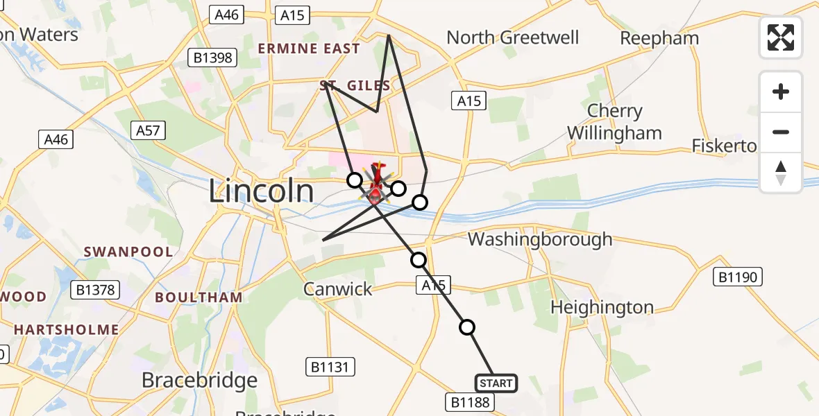
On Saturday, 14 February 2026 at 10:30, a Air Ambulance Helicopter departed from Branston to Lincoln. It was the Air Ambulance Helicopter with registration number G-DRLA. The flight lasted 5 minutes. During that period, the aircraft travelled 9 miles at an average speed of 108 miles per hour at a maximum altitude of 725 feet.
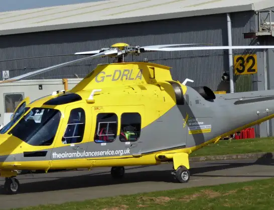
Helicopter: G-DRLA
The helicopter G-DRLA is used as an ambulance helicopter. The helicopter is equipped with a stretcher for transporting patients. The helicopter is often used to transport to hospitals.
Photo: Alec Wilson
10 miles
725 feet
108 mph
6 minutes
10:30
10:35

Route
Monks Road, Greater Lincolnshire10:35
Lincoln, Greater Lincolnshire10:33
Bracebridge, Lincoln10:33
Lincoln, Greater Lincolnshire10:31
Bracebridge, Lincoln10:31
Washingborough, North Kesteven10:30
Deansway, North Kesteven10:30
Live flights
Police Helicopter on its way from Dundrod12 Jul 22:50
Today
Police Helicopter to East Ardsley, Stoney Lane12 Jul 23:51
Police Helicopter to Birmingham Airport12 Jul 23:46
Air Ambulance Helicopter to Newlands of Culloden12 Jul 23:24
Flights Lincoln
Air Ambulance Helicopter to Nottingham Heliport24 Jun 21:37
Air Ambulance Helicopter to Lincoln, Laney Close24 Jun 21:14
Flights Branston
Air Ambulance Helicopter to Branston, Parkway12 Jul 12:37
Air Ambulance Helicopter to Nottingham Heliport21 Jun 09:10
Air Ambulance Helicopter to RAF Waddington21 Jun 08:58
Air Ambulance Helicopter to Lincoln, Monks Road14 Feb 10:30
Helicopter flights on your website?
You can easily display helicopter flights on your own website. Use the embed code.
