Air Ambulance Helicopter to University Hospital Southampton, University Hospital Southampton
Friday, 13 February 2026 | 0:20 | From Bournemouth Airport
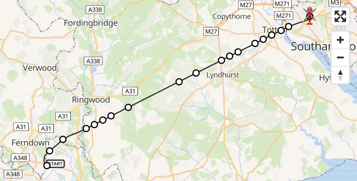
On Friday, 13 February 2026 at 0:20, a Air Ambulance Helicopter departed from Bournemouth Airport to University Hospital Southampton. It was the Air Ambulance Helicopter with registration number G-DSAA. The flight lasted 12 minutes. During that period, the aircraft travelled 24 miles at an average speed of 117 miles per hour at a maximum altitude of 1725 feet.
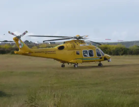
Helicopter: G-DSAA
The helicopter G-DSAA is used as a air ambulance helicopter. The main purpose of this aircraft is to transport a Mobile Medical Team to an incident as quickly as possible, enabling the trauma doctor to provide immediate first aid on site. The aircraft is flying this flight as Air Ambulance Helicopter.
Photo: Andrew Bone
24 miles
1725 feet
117 mph
13 minutes
00:20
00:33

Route
University Hospital Southampton, Southampton00:33
University Hospital Southampton, Southampton00:32
University Hospital Southampton, Southampton00:31
Southampton00:30
Eling, Totton00:29
Eling, Southampton00:29
West Totton, New Forest00:29
Ashurst, New Forest00:29
Woodlands, New Forest00:28
New Forest00:28
Lyndhurst, New Forest00:28
Emery Down, New Forest00:27
New Forest00:26
Burley, New Forest00:25
Hightown, New Forest00:24
Ringwood, New Forest00:24
RAF Bisterne, Ringwood, Hampshire00:24
New Forest00:24
St. Leonards and St. Ives00:23
Hurn00:22
Parley Cross00:22
Bournemouth Airport, Bournemouth00:21
Bournemouth Airport, Bournemouth00:20
Live flights
Today
Helicopter flights on your website?
You can easily display helicopter flights on your own website. Use the embed code.
