Air Ambulance Helicopter to Armthorpe, Barton Lane
Thursday, 12 February 2026 | 10:12 | From YAA Nostell Helicopter Port
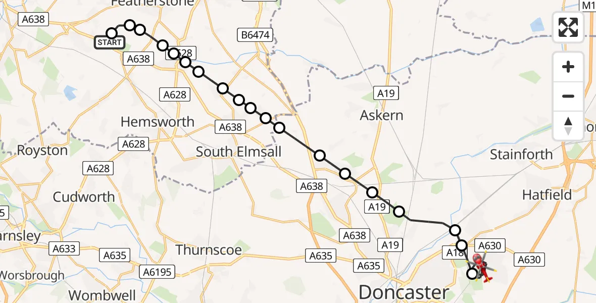
On Thursday, 12 February 2026 at 10:12, a Air Ambulance Helicopter departed from YAA Nostell Helicopter Port to Armthorpe. It was the Air Ambulance Helicopter with registration number G-YORX. The flight lasted 11 minutes. During that period, the aircraft travelled 20 miles at an average speed of 107 miles per hour at a maximum altitude of 1750 feet.
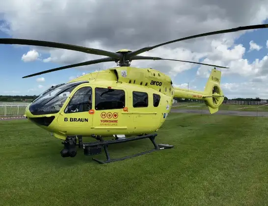
Helicopter: G-YORX
The helicopter G-YORX is used as a air ambulance helicopter. The main purpose of this aircraft is to transport a Mobile Medical Team to an incident as quickly as possible, enabling the trauma doctor to provide immediate first aid on site. The aircraft is flying this flight as Air Ambulance Helicopter.
Photo: Arollin96227
20 miles
1750 feet
107 mph
12 minutes
10:12
10:23

Route
Barton Lane, Doncaster10:23
Armthorpe, Doncaster10:20
Edenthorpe, Doncaster10:20
Kirk Sandall, Doncaster10:19
Arksey, Doncaster10:18
Toll Bar, Doncaster10:18
Carcroft, Doncaster10:17
Skellow, Doncaster10:17
Hampole, Doncaster10:16
Wakefield, West Yorkshire10:16
North Elmsall, Wakefield10:16
Upton, Wakefield10:15
Thorpe Audlin, Wakefield10:15
Badsworth, Wakefield10:15
Low Ackworth, Wakefield10:14
High Ackworth, Wakefield10:14
Ackworth Moor Top, Wakefield10:14
Wragby, Wakefield10:13
Wakefield, West Yorkshire10:13
Nostell, Wakefield10:13
YAA Nostell Helicopter Port, Foulby, Nostell, Yorkshire10:12
Live flights
Police Helicopter on its way from Ewelme13 Jul 22:24
Today
Police Helicopter to Bournemouth Airport13 Jul 23:55
Air Ambulance Helicopter to Cardiff Heliport13 Jul 23:38
Police Helicopter to Birmingham Airport13 Jul 23:21
Police Helicopter to Irlam, Twelve Yards Road13 Jul 23:00
Flights Armthorpe
Air Ambulance Helicopter to Armthorpe, M1828 Mar 14:23
Helicopter flights on your website?
You can easily display helicopter flights on your own website. Use the embed code.
