Air Ambulance Helicopter to Caerau, Tudor Estate
Wednesday, 11 February 2026 | 13:17 | From Briton Ferry
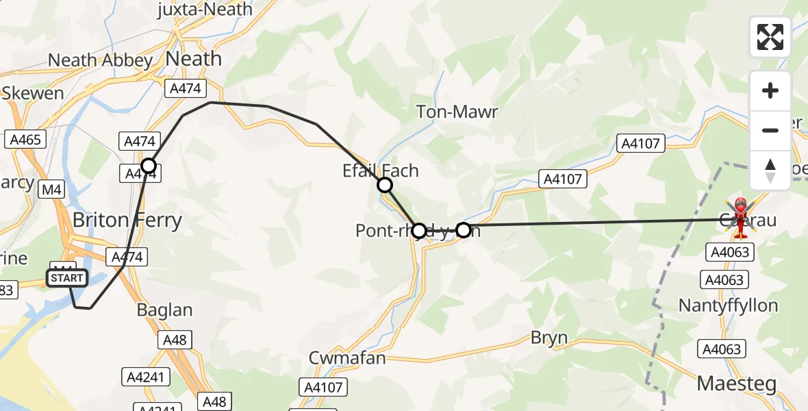
On Wednesday, 11 February 2026 at 13:17, a Air Ambulance Helicopter departed from Briton Ferry to Caerau. It was the Air Ambulance Helicopter with registration number G-WROL. The flight lasted 6 minutes. During that period, the aircraft travelled 10 miles at an average speed of 103 miles per hour at a maximum altitude of 2100 feet.
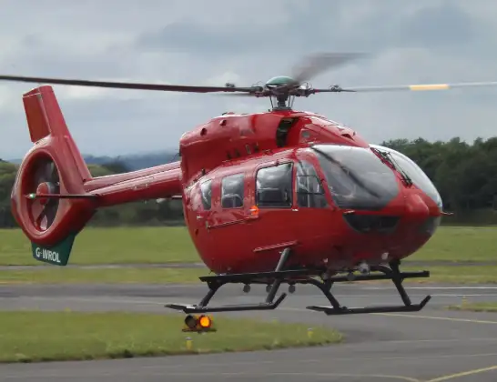
Helicopter: G-WROL
The helicopter G-WROL is used as a air ambulance helicopter. The main purpose of this aircraft is to transport a Mobile Medical Team to an incident as quickly as possible, enabling the trauma doctor to provide immediate first aid on site. The aircraft is flying this flight as Air Ambulance Helicopter.
Photo: James from Cheltenham, Gloucestershire
11 miles
2100 feet
103 mph
6 minutes
13:17
13:23

Route
Tudor Estate, 13:23
Cwmavon13:20
Pont-rhyd-y-fen13:20
Efail Fach13:20
Neath13:18
Fabian Way, 13:17
Live flights
Today
Police Helicopter to Manchester Barton Aerodrome13 Jul 23:56
Police Helicopter to Bournemouth Airport13 Jul 23:55
Air Ambulance Helicopter to Cardiff Heliport13 Jul 23:38
Police Helicopter to Harborough, Sulby Road13 Jul 23:36
Police Helicopter to Birmingham Airport13 Jul 23:21
Flights Caerau
Police Helicopter to Almondsbury Helicopter Base27 Apr 20:56
Police Helicopter to Caerau, Dyfrig Close27 Apr 20:11
Air Ambulance Helicopter to Caerau, Tudor Estate11 Feb 13:17
Helicopter flights on your website?
You can easily display helicopter flights on your own website. Use the embed code.
