Air Ambulance Helicopter to Kidlington, Banbury Road
Wednesday, 11 February 2026 | 12:05 | From Stadhampton
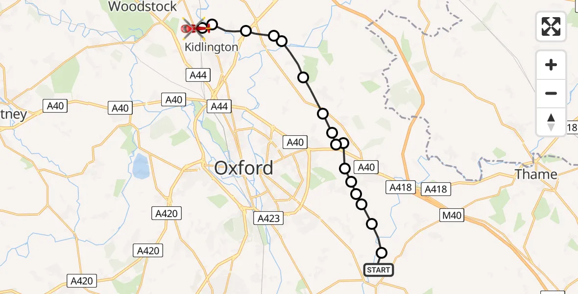
On Wednesday, 11 February 2026 at 12:05, a Air Ambulance Helicopter departed from Stadhampton to Kidlington. It was the Air Ambulance Helicopter with registration number G-DAAN. The flight lasted 7 minutes. During that period, the aircraft travelled 15 miles at an average speed of 123 miles per hour at a maximum altitude of 2250 feet.
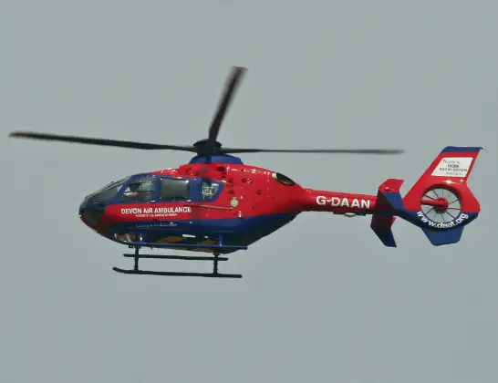
Helicopter: G-DAAN
The helicopter G-DAAN is used as a air ambulance helicopter. The main purpose of this aircraft is to transport a Mobile Medical Team to an incident as quickly as possible, enabling the trauma doctor to provide immediate first aid on site. The aircraft is flying this flight as Air Ambulance Helicopter.
Photo: Alan Wilson
15 miles
2250 feet
123 mph
8 minutes
12:05
12:12

Route
Banbury Road, Cherwell12:12
Kidlington, Cherwell12:12
Cherwell12:12
Hampton Poyle, Cherwell12:11
Islip, Cherwell12:10
Oddington, Cherwell12:10
Noke, Cherwell12:09
Beckley, South Oxfordshire12:09
Stanton St John, South Oxfordshire12:08
South Oxfordshire12:08
Stanton St John, South Oxfordshire12:08
Horspath, South Oxfordshire12:08
Wheatley, South Oxfordshire12:07
Cuddesdon, South Oxfordshire12:07
Slay Barn Private Airstrip, Oxford, Oxfordshire12:07
Cuddesdon, South Oxfordshire12:06
Little Milton, South Oxfordshire12:06
Cuddeston Road, South Oxfordshire12:05
Live flights
Police Helicopter on its way from Ewelme13 Jul 22:24
Today
Police Helicopter to Bournemouth Airport13 Jul 23:55
Air Ambulance Helicopter to Cardiff Heliport13 Jul 23:38
Police Helicopter to Birmingham Airport13 Jul 23:21
Police Helicopter to Irlam, Twelve Yards Road13 Jul 23:00
Flights Kidlington
Police Helicopter to Kidlington, Woodstock Road10 Jul 14:44
Air Ambulance Helicopter to Oxford, Headley Way10 Jun 12:19
Police Helicopter to Kidlington, Canal Road8 Jun 10:49
Police Helicopter to North Weald Airfield29 Apr 15:18
Police Helicopter to Kidlington, Bladon24 Apr 13:38
Flights Stadhampton
Air Ambulance Helicopter to Stadhampton, B48010 Jun 13:28
Police Helicopter to Stadhampton27 Jan 19:44
Helicopter flights on your website?
You can easily display helicopter flights on your own website. Use the embed code.
