Air Ambulance Helicopter to Durlston, Victoria Avenue
Wednesday, 11 February 2026 | 10:59 | From Henstridge Airfield
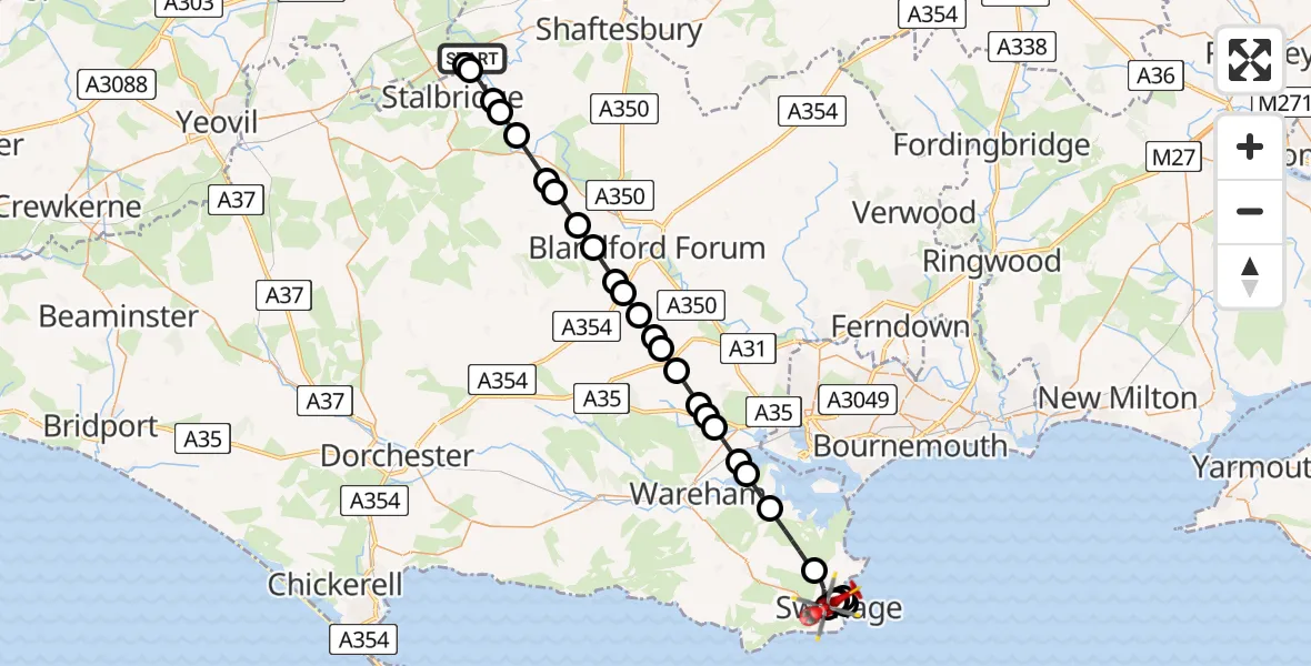
On Wednesday, 11 February 2026 at 10:59, a Air Ambulance Helicopter departed from Henstridge Airfield to Durlston. It was the Air Ambulance Helicopter with registration number G-DSAA. The flight lasted 15 minutes. During that period, the aircraft travelled 34 miles at an average speed of 132 miles per hour at a maximum altitude of 1975 feet.
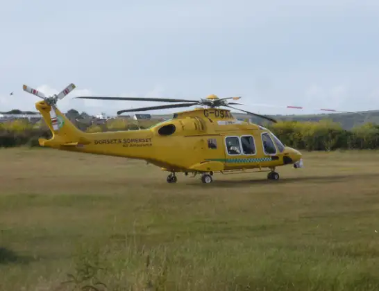
Helicopter: G-DSAA
The helicopter G-DSAA is used as a air ambulance helicopter. The main purpose of this aircraft is to transport a Mobile Medical Team to an incident as quickly as possible, enabling the trauma doctor to provide immediate first aid on site. The aircraft is flying this flight as Air Ambulance Helicopter.
Photo: Andrew Bone
34 miles
1975 feet
132 mph
16 minutes
10:59
11:14

Route
Victoria Avenue, Swanage11:14
Durlston, Swanage11:14
Swanage11:14
Durlston, Swanage11:13
Durlston11:13
Durlston, Swanage11:12
Swanage11:11
Corfe Castle11:10
Arne11:09
Wareham St. Martin11:09
Holton Heath11:08
Lytchett Minster and Upton11:08
Poole11:08
Morden11:07
Winterborne Zelston11:06
Sturminster Marshall11:06
Spetisbury11:06
Charlton Marshall11:05
Blandford St. Mary11:05
Winterborne Stickland11:04
Durweston11:04
Shillingstone11:03
Okeford Fitzpaine11:03
Sturminster Newton11:02
Hinton St Mary11:01
Marnhull11:01
Stalbridge11:00
Henstridge11:00
Henstridge Airfield, Templecombe, Somerset10:59
Henstridge Airfield, Templecombe, Somerset10:59
Live flights
Police Helicopter on its way from RAF Benson12 Jul 22:54
Police Helicopter on its way from Dundrod12 Jul 22:50
Police Helicopter on its way from East Ardsley12 Jul 22:44
Today
Air Ambulance Helicopter to Glasgow Airport12 Jul 22:48
Air Ambulance Helicopter to Norwich Airport12 Jul 22:27
Air Ambulance Helicopter to Northrepps Aerodrome12 Jul 22:23
Police Helicopter to Harborough, Sulby Road12 Jul 22:20
Air Ambulance Helicopter to Derriford Hospital12 Jul 22:12
Police Helicopter to Manchester Barton Aerodrome12 Jul 22:11
Air Ambulance Helicopter to Northrepps Aerodrome12 Jul 22:03
Flights Durlston
Police Helicopter to English Channel14 Jun 18:50
Police Helicopter to Durlston, Swanage Pier14 Jun 18:29
Air Ambulance Helicopter to Durlston, Broad Road31 Mar 12:53
Coastguard Helicopter to Solent Airport29 Mar 16:02
Coastguard Helicopter to Durlston29 Mar 15:45
Coastguard Helicopter to Durlston29 Mar 14:57
Air Ambulance Helicopter to Durlston28 Mar 07:58
Helicopter flights on your website?
You can easily display helicopter flights on your own website. Use the embed code.
