Air Ambulance Helicopter to Gorslas, Church Road
Wednesday, 11 February 2026 | 10:00 | From Dafen
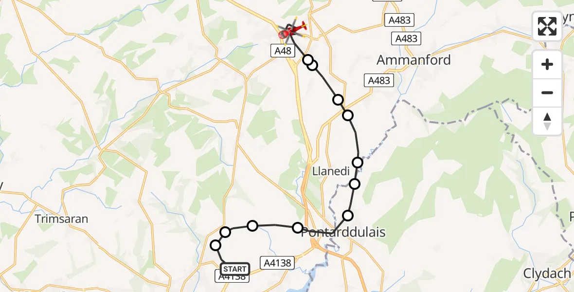
On Wednesday, 11 February 2026 at 10:00, a Air Ambulance Helicopter departed from Dafen to Gorslas. It was the Air Ambulance Helicopter with registration number G-WROL. The flight lasted 9 minutes. During that period, the aircraft travelled 13 miles at an average speed of 89 miles per hour at a maximum altitude of 1800 feet.
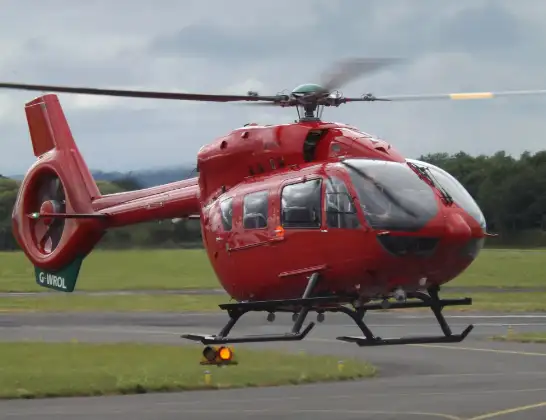
Helicopter: G-WROL
The helicopter G-WROL is used as a air ambulance helicopter. The main purpose of this aircraft is to transport a Mobile Medical Team to an incident as quickly as possible, enabling the trauma doctor to provide immediate first aid on site. The aircraft is flying this flight as Air Ambulance Helicopter.
Photo: James from Cheltenham, Gloucestershire
14 miles
1800 feet
89 mph
9 minutes
10:00
10:09

Route
Church Road, 10:09
Gorslas10:06
Cwmgwili10:06
Capel Hendre10:05
Tycroes10:05
Llanedi10:04
Garnswllt10:04
Pontarddulais10:03
Hendy10:02
Llangennech10:02
Llanelli Rural10:01
Fronhaul, 10:01
Dafen10:00
Live flights
Today
Flights Gorslas
Air Ambulance Helicopter to Dafen, Heol Aur14 Apr 10:24
Air Ambulance Helicopter to Gorslas, Church Road14 Apr 09:32
Air Ambulance Helicopter to Dafen, Heol Aur11 Feb 10:45
Air Ambulance Helicopter to Gorslas, Church Road11 Feb 10:00
Flights Dafen
Air Ambulance Helicopter to Dafen, Heol Aur13 Jul 18:27
Air Ambulance Helicopter to Barry, Waycock Road13 Jul 14:28
Air Ambulance Helicopter to Dafen, Heol Aur13 Jul 12:46
Air Ambulance Helicopter to Cray13 Jul 10:03
Air Ambulance Helicopter to Dafen, Heol Aur12 Jul 16:00
Air Ambulance Helicopter to Nantmel, A4412 Jul 13:50
Air Ambulance Helicopter to Dafen, Heol Aur12 Jul 08:18
Air Ambulance Helicopter to Dafen, Heol Aur11 Jul 18:18
Air Ambulance Helicopter to Llywel11 Jul 15:17
Air Ambulance Helicopter to Dafen, Heol Aur11 Jul 11:03
Helicopter flights on your website?
You can easily display helicopter flights on your own website. Use the embed code.
