Air Ambulance Helicopter to Shipton-on-Cherwell, Upper Campsfield Road
Tuesday, 10 February 2026 | 12:30 | From Yarnton
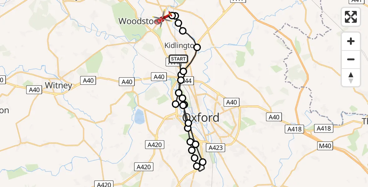
On Tuesday, 10 February 2026 at 12:30, a Air Ambulance Helicopter departed from Yarnton to Shipton-on-Cherwell. It was the Air Ambulance Helicopter with registration number G-DAAN. The flight lasted 10 minutes. During that period, the aircraft travelled 21 miles at an average speed of 122 miles per hour at a maximum altitude of 2075 feet.
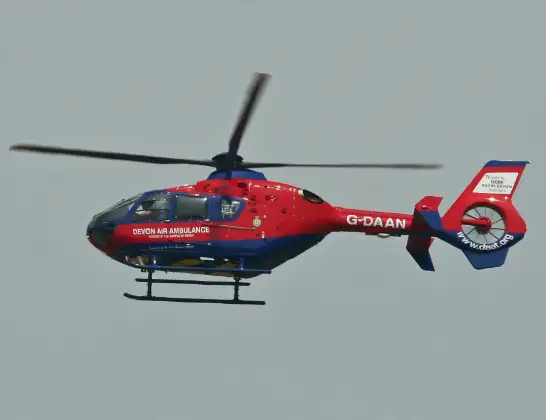
Helicopter: G-DAAN
The helicopter G-DAAN is used as a air ambulance helicopter. The main purpose of this aircraft is to transport a Mobile Medical Team to an incident as quickly as possible, enabling the trauma doctor to provide immediate first aid on site. The aircraft is flying this flight as Air Ambulance Helicopter.
Photo: Alan Wilson
22 miles
2075 feet
122 mph
11 minutes
12:30
12:40

Route
Upper Campsfield Road, Cherwell12:40
Shipton-on-Cherwell, Cherwell12:40
Bletchingdon, Cherwell12:40
Thrupp, Cherwell12:39
Cherwell12:39
Hampton Poyle, Cherwell12:38
Cherwell12:38
Oxford12:37
Wytham, Vale of White Horse12:37
Binsey, Oxford12:36
Oxford12:36
South Hinksey, Vale of White Horse12:35
Kennington, Vale of White Horse12:35
Radley, Vale of White Horse12:34
Kennington, Oxford12:34
Kennington, Vale of White Horse12:33
South Hinksey, Vale of White Horse12:33
Botley and North Hinksey, Vale of White Horse12:33
Oxford12:32
Binsey, Oxford12:32
Oxford12:31
Cherwell12:30
Green Lane, Cherwell12:30
Live flights
Police Helicopter on its way from Ewelme13 Jul 22:24
Today
Police Helicopter to Bournemouth Airport13 Jul 23:55
Air Ambulance Helicopter to Cardiff Heliport13 Jul 23:38
Police Helicopter to Birmingham Airport13 Jul 23:21
Police Helicopter to Irlam, Twelve Yards Road13 Jul 23:00
Flights Shipton-on-Cherwell
Flights Yarnton
Air Ambulance Helicopter to RAF Benson22 Jun 11:35
Helicopter flights on your website?
You can easily display helicopter flights on your own website. Use the embed code.
