Air Ambulance Helicopter to Eastnor, A438
Monday, 9 February 2026 | 10:24 | From Cheltenham
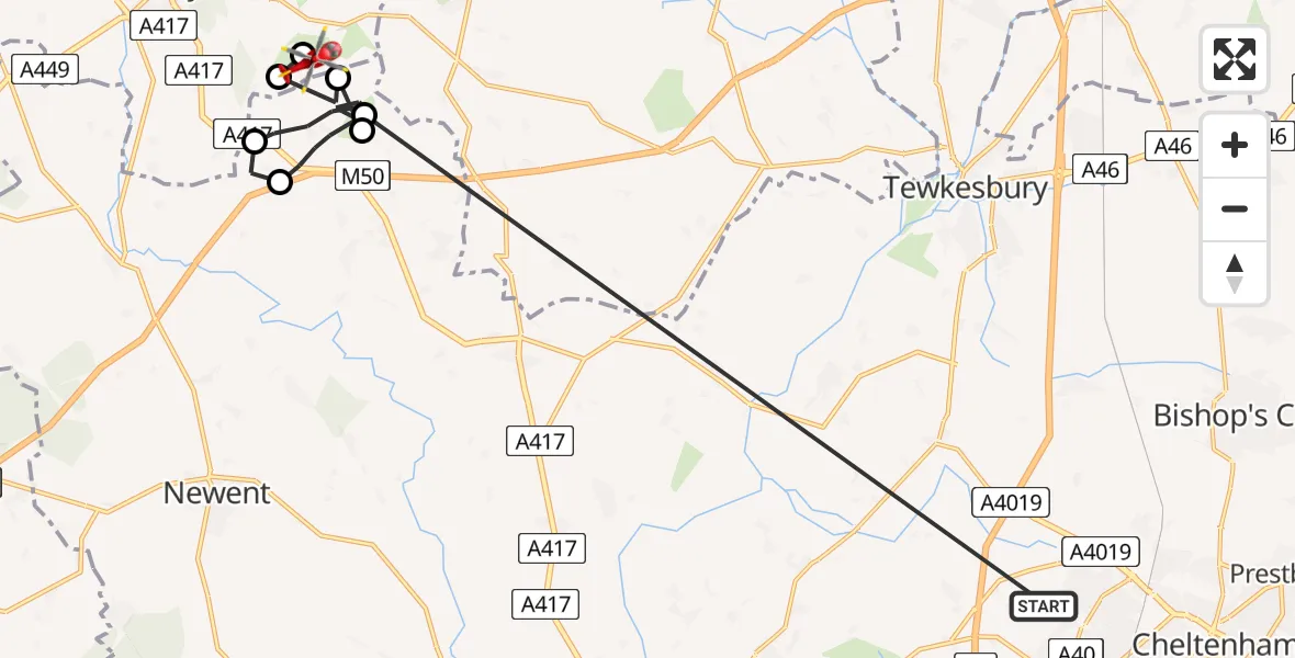
On Monday, 9 February 2026 at 10:24, a Air Ambulance Helicopter departed from Cheltenham to Eastnor. It was the Air Ambulance Helicopter with registration number G-SCAA. The flight lasted 12 minutes. During that period, the aircraft travelled 20 miles at an average speed of 106 miles per hour at a maximum altitude of 2275 feet.
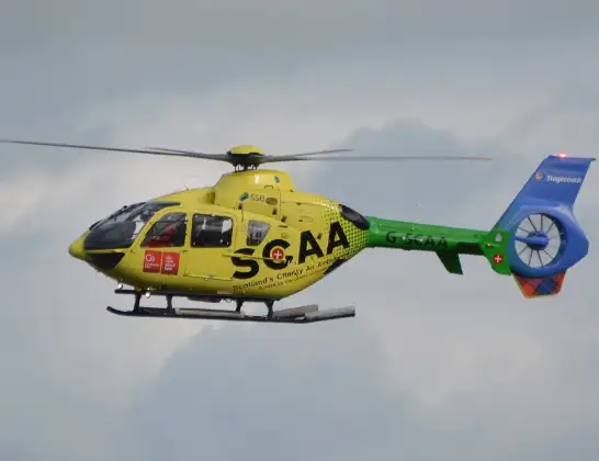
Helicopter: G-SCAA
The helicopter G-SCAA is used as a air ambulance helicopter. The main purpose of this aircraft is to transport a Mobile Medical Team to an incident as quickly as possible, enabling the trauma doctor to provide immediate first aid on site. The aircraft is flying this flight as Air Ambulance Helicopter.
Photo: Jonathan Payne
21 miles
2275 feet
106 mph
12 minutes
10:24
10:35

Route
A438, 10:35
Eastnor10:35
Bromsberrow10:35
Bromsberrow, Forest of Dean10:34
Berrow Airstrip, Ledbury, Hertfordshire10:30
Bromsberrow, Forest of Dean10:25
Bromesberrow Heath, Forest of Dean10:25
Bromsberrow, Forest of Dean10:24
Henley Road, 10:24
Today
Police Helicopter to Falkirk02:12:08
Flights Eastnor
Air Ambulance Helicopter to Eastnor, A43818 May 14:36
Air Ambulance Helicopter to Eastnor, A4389 Feb 10:24
Flights Cheltenham
Police Helicopter to Gloucestershire Airport6 Jul 12:26
Helicopter flights on your website?
You can easily display helicopter flights on your own website. Use the embed code.
