Air Ambulance Helicopter to Newcastle Royal Victoria Infirmary
Sunday, 8 February 2026 | 13:24 | From Stanhope
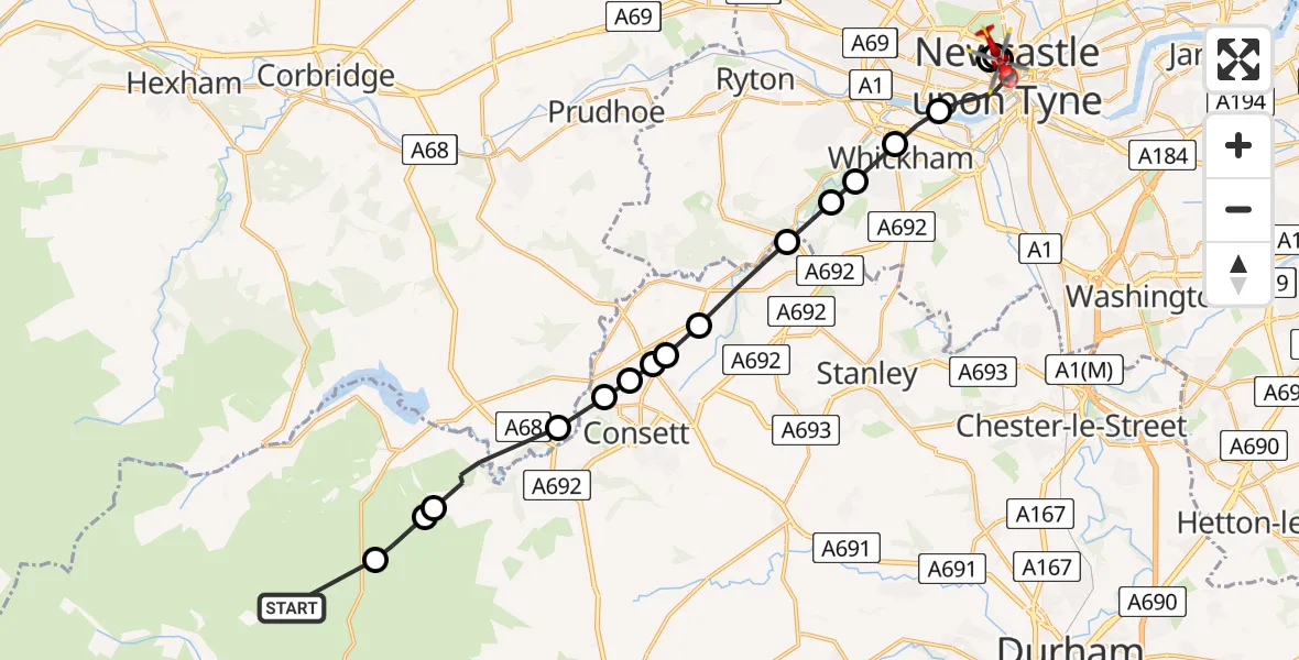
On Sunday, 8 February 2026 at 13:24, a Air Ambulance Helicopter departed from Stanhope to Newcastle Royal Victoria Infirmary. It was the Air Ambulance Helicopter with registration number G-NHAE. The flight lasted 11 minutes. During that period, the aircraft travelled 22 miles at an average speed of 126 miles per hour at a maximum altitude of 2275 feet.
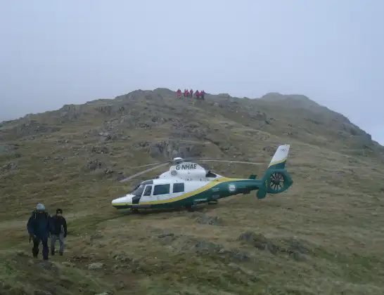
Helicopter: G-NHAE
The helicopter G-NHAE is used as a air ambulance helicopter. The main purpose of this aircraft is to transport a Mobile Medical Team to an incident as quickly as possible, enabling the trauma doctor to provide immediate first aid on site. The aircraft is flying this flight as Air Ambulance Helicopter.
Photo: Michael Earnshaw
23 miles
2275 feet
126 mph
11 minutes
13:24
13:35

Route
Newcastle Royal Victoria Infirmary, Newcastle upon Tyne13:35
Newcastle Royal Victoria Infirmary, Newcastle upon Tyne13:34
Newcastle upon Tyne, North East13:34
Newcastle Royal Victoria Infirmary, Newcastle upon Tyne13:33
Newcastle Royal Victoria Infirmary, Newcastle upon Tyne13:32
Newcastle upon Tyne, North East13:31
Whickham, North East13:30
Swalwell, Gateshead13:30
Winlaton Mill, Gateshead13:30
Rowlands Gill, Gateshead13:29
Hamsterley Mill, North East13:28
Medomsley, North East13:28
The Dene, North East13:28
Consett, North East13:28
Benfieldside, Consett13:27
Consett, North East13:27
Muggleswick, North East13:26
Consett, North East13:25
Muggleswick, North East13:25
Meadows Edge, North East13:24
Today
Flights Stanhope
Police Helicopter to Consett15 Jun 13:49
Police Helicopter to Allenheads, B629515 Jun 13:42
Police Helicopter to Stanhope, A68915 Jun 13:38
Police Helicopter to Stanhope15 Jun 12:57
Air Ambulance Helicopter to Stanhope10 May 17:59
Police Helicopter to Durham, B653229 Apr 09:52
Helicopter flights on your website?
You can easily display helicopter flights on your own website. Use the embed code.
