Coastguard Helicopter to Purbrook, Geoffrey Avenue
Thursday, 5 February 2026 | 23:18 | From Portsmouth
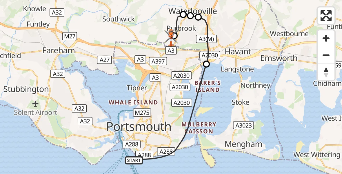
On Thursday, 5 February 2026 at 23:18, a Coastguard Helicopter departed from Portsmouth to Purbrook. It was the Coastguard Helicopter with registration number G-RESF. The flight lasted 15 minutes. During that period, the aircraft travelled 11 miles at an average speed of 46 miles per hour at a maximum altitude of 1475 feet.

Helicopter: G-RESF
The helicopter G-RESF is used by the British Coastguard. The helicopter is deployed in search and rescue operations at sea, rescue operations involving ships or drilling platforms, patrols to prevent smuggling or piracy, environmental monitoring and disaster relief support.
Photo: Tony Melony
12 miles
1475 feet
46 mph
15 minutes
23:18
23:33

Route
Geoffrey Avenue, Havant23:33
Purbrook, Havant23:29
Winchester23:25
Waterlooville23:25
Purbrook, Havant23:24
Havant23:22
South Parade, 23:19
Portsmouth23:18
Live flights
Today
Coastguard Helicopter to Wasdale19:10:08
Flights Purbrook
Police Helicopter to Purbrook, Laburnum Road10 Jan 10:46
Flights Portsmouth
Air Ambulance Helicopter to Southampton Airport30 May 21:38
Helicopter flights on your website?
You can easily display helicopter flights on your own website. Use the embed code.
