Police Helicopter to Bournemouth Airport, Bournemouth Airport
Wednesday, 4 February 2026 | 20:35 | From Bournemouth Airport
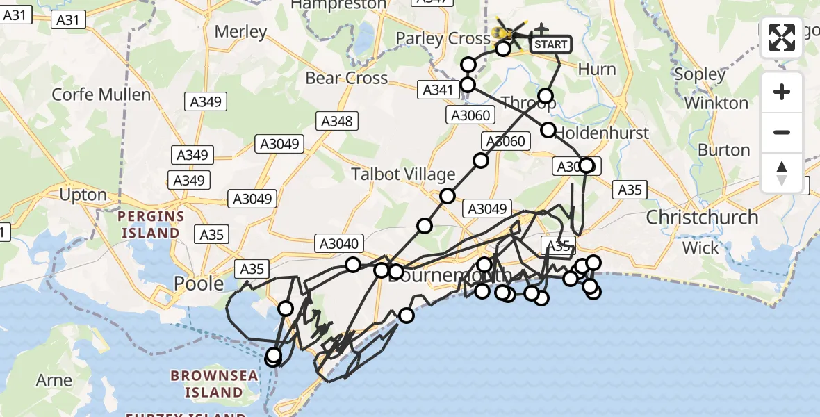
On Wednesday, 4 February 2026 at 20:35, a Police Helicopter departed from Bournemouth Airport to Bournemouth Airport. It was the Police Helicopter with registration number G-CPAO. The flight lasted 65 minutes. During that period, the aircraft travelled 72 miles at an average speed of 66 miles per hour at a maximum altitude of 2825 feet.
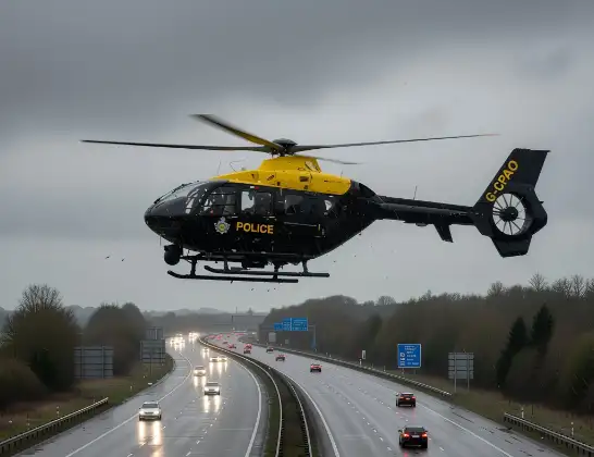
Helicopter: G-CPAO
The helicopter G-CPAO is used by the British police. The helicopter is deployed in pursuits, missing persons cases and other incidents where a helicopter provides added value.
Photo: Tony Melony
72 miles
2825 feet
66 mph
66 minutes
20:35
21:41

Route
Bournemouth Airport, Bournemouth21:41
Bournemouth Airport, Bournemouth21:40
Parley Cross21:40
Bournemouth21:39
Throop, Bournemouth21:39
Holdenhurst, Bournemouth21:38
Bournemouth21:33
Poole21:26
Studland21:26
Poole21:26
Studland21:25
Poole21:16
Bournemouth21:13
Wick, Bournemouth21:13
Bournemouth21:13
Wick, Bournemouth21:12
Bournemouth21:12
Wick, Bournemouth21:12
Bournemouth21:09
English Channel21:09
Bournemouth21:08
English Channel21:08
Bournemouth21:05
English Channel21:05
Bournemouth20:56
Poole20:38
Bournemouth20:37
Talbot Village, Bournemouth20:37
Bournemouth20:37
Throop, Bournemouth20:36
Bournemouth Airport, Bournemouth20:35
Live flights
Today
Helicopter flights on your website?
You can easily display helicopter flights on your own website. Use the embed code.
