Air Ambulance Helicopter to Coventry Airport, Coventry Airport
Wednesday, 4 February 2026 | 15:15 | From Tyseley
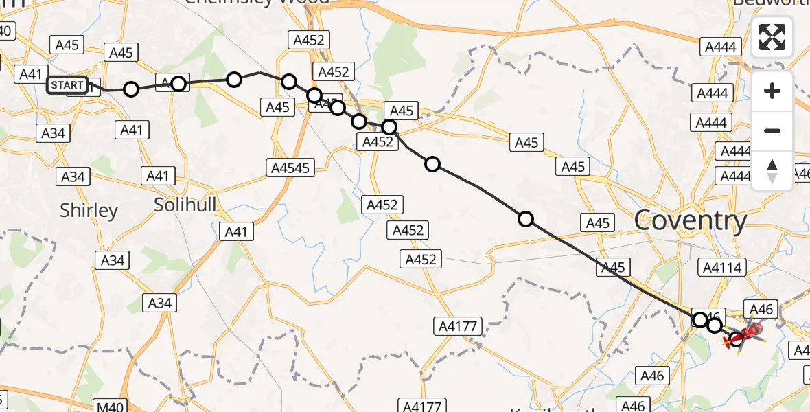
On Wednesday, 4 February 2026 at 15:15, a Air Ambulance Helicopter departed from Tyseley to Coventry Airport. It was the Air Ambulance Helicopter with registration number G-WNAS. The flight lasted 8 minutes. During that period, the aircraft travelled 17 miles at an average speed of 127 miles per hour at a maximum altitude of 1725 feet.
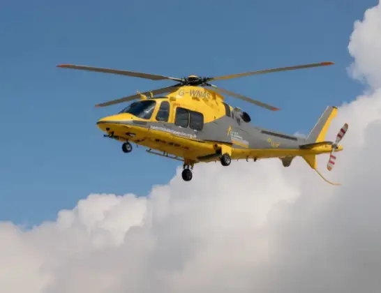
Helicopter: G-WNAS
The helicopter G-WNAS is used as an ambulance helicopter. The helicopter is equipped with a stretcher for transporting patients. The helicopter is often used to transport to hospitals.
Photo: Tony Melony
17 miles
1725 feet
127 mph
8 minutes
15:15
15:23

Route
Coventry Airport, Coventry, West Midlands15:23
Coventry Airport, Coventry, West Midlands15:23
Baginton, Warwick15:22
Baginton, Coventry15:22
Coventry, West Midlands15:20
Berkswell, Solihull15:19
Meriden, Solihull15:19
Hampton in Arden, Solihull15:18
Solihull, West Midlands15:18
Bickenhill, Solihull15:18
Birmingham, West Midlands15:18
Birmingham Airport, Birmingham, West Midlands15:17
Birmingham, West Midlands15:17
Olton, Solihull15:16
Heathcliff Road, Birmingham15:15
Live flights
Today
Flights Tyseley
Helicopter flights on your website?
You can easily display helicopter flights on your own website. Use the embed code.
