Air Ambulance Helicopter to Elmbridge, Ewell Road
Friday, 30 January 2026 | 22:46 | From Redhill Aerodrome
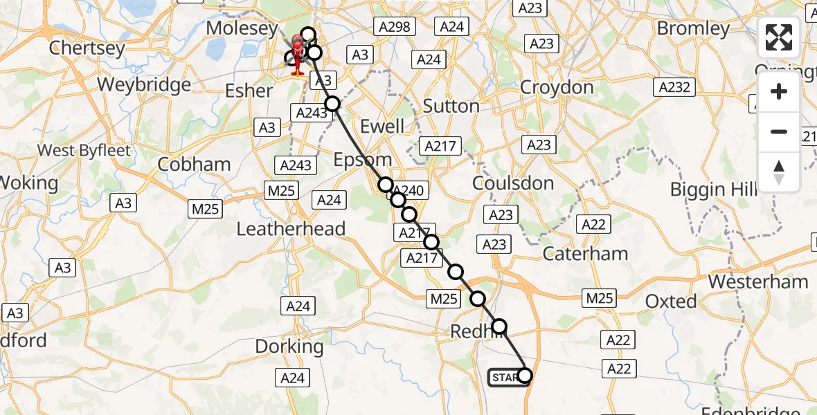
On Friday, 30 January 2026 at 22:46, a Air Ambulance Helicopter departed from Redhill Aerodrome to Elmbridge. It was the Air Ambulance Helicopter with registration number G-KSSC. The flight lasted 12 minutes. During that period, the aircraft travelled 19 miles at an average speed of 95 miles per hour at a maximum altitude of 2075 feet.
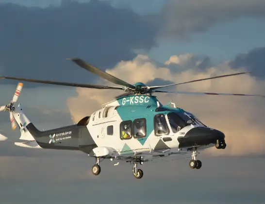
Helicopter: G-KSSC
The helicopter G-KSSC is used as a air ambulance helicopter. The main purpose of this aircraft is to transport a Mobile Medical Team to an incident as quickly as possible, enabling the trauma doctor to provide immediate first aid on site. The aircraft is flying this flight as Air Ambulance Helicopter.
Photo: Shona aakss
20 miles
2075 feet
95 mph
13 minutes
22:46
22:58

Route
Elmbridge22:58
Ewell Road, 22:58
Ewell Road, 22:56
Elmbridge22:55
London Borough of Richmond upon Thames, Greater London22:54
Royal Borough of Kingston upon Thames, Greater London22:54
Elmbridge22:53
London Borough of Richmond upon Thames, Greater London22:53
Royal Borough of Kingston upon Thames, Greater London22:52
Epsom, Epsom and Ewell22:51
Tattenham Corner, Reigate and Banstead22:50
Tadworth, Reigate and Banstead22:50
Kingswood, Reigate and Banstead22:50
Lower Kingswood, Reigate and Banstead22:49
Gatton, Reigate and Banstead22:49
Redhill, Reigate and Banstead22:48
South Nutfield22:47
Redhill Aerodrome, Redhill, Surrey22:46
Live flights
Today
Police Helicopter to Benson, Clack's Lane30 May 23:59
Air Ambulance Helicopter to Southampton Airport30 May 23:23
Coastguard Helicopter to English Channel30 May 23:12
Police Helicopter to South Nutfield, M2330 May 22:51
Police Helicopter to Manchester Barton Aerodrome30 May 22:31
Coastguard Helicopter to Manston Airport30 May 22:23
Police Helicopter to MOD St Athan30 May 22:09
Flights Elmbridge
Air Ambulance Helicopter to St Georges Hospital13 May 17:54
Air Ambulance Helicopter to Fairoaks Airport29 Mar 11:28
Air Ambulance Helicopter to Redhill Aerodrome30 Jan 23:24
Helicopter flights on your website?
You can easily display helicopter flights on your own website. Use the embed code.
