Air Ambulance Helicopter to Nantyffyllon, North's Navigation Railway
Friday, 30 January 2026 | 10:54 | From Gorseinon
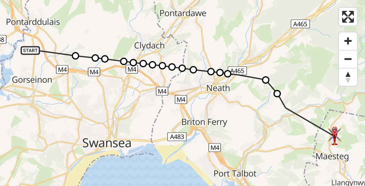
On Friday, 30 January 2026 at 10:54, a Air Ambulance Helicopter departed from Gorseinon to Nantyffyllon. It was the Air Ambulance Helicopter with registration number G-WROL. The flight lasted 9 minutes. During that period, the aircraft travelled 18 miles at an average speed of 120 miles per hour at a maximum altitude of 2150 feet.
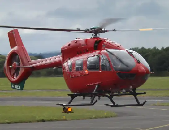
Helicopter: G-WROL
The helicopter G-WROL is used as a air ambulance helicopter. The main purpose of this aircraft is to transport a Mobile Medical Team to an incident as quickly as possible, enabling the trauma doctor to provide immediate first aid on site. The aircraft is flying this flight as Air Ambulance Helicopter.
Photo: James from Cheltenham, Gloucestershire
18 miles
2150 feet
120 mph
10 minutes
10:54
11:03

Route
North's Navigation Railway, 11:03
Ton-Mawr11:01
Tonna11:00
Aberdulais10:59
Cadoxton-juxta-Neath10:59
Bryncoch10:59
Neath10:58
Neath Abbey10:58
Birchgrove10:58
Glais10:57
Parc Bryn Heulog10:57
Ynystawe10:57
Clydach10:57
Ynystawe10:56
Llangyfelach10:56
Swansea10:56
Llangyfelach10:55
Grove Farm Road, 10:54
Today
Police Helicopter to Epping Forest, Green Lane26 Feb 23:43
Flights Nantyffyllon
Air Ambulance Helicopter to Bridgend, Crack Hill11 Feb 15:06
Flights Gorseinon
Helicopter flights on your website?
You can easily display helicopter flights on your own website. Use the embed code.
