Air Ambulance Helicopter to Wool, East Burton Road
Friday, 30 January 2026 | 8:09 | From Henstridge Airfield
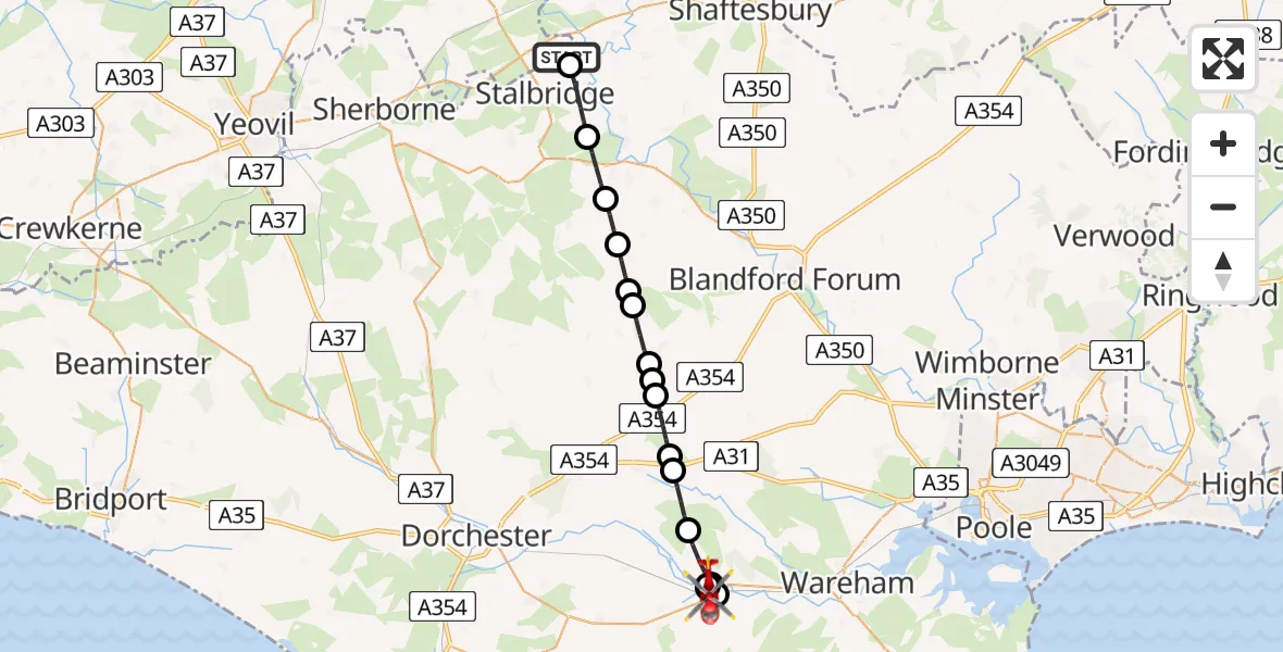
On Friday, 30 January 2026 at 8:09, a Air Ambulance Helicopter departed from Henstridge Airfield to Wool. It was the Air Ambulance Helicopter with registration number G-DSAA. The flight lasted 12 minutes. During that period, the aircraft travelled 24 miles at an average speed of 123 miles per hour at a maximum altitude of 2175 feet.
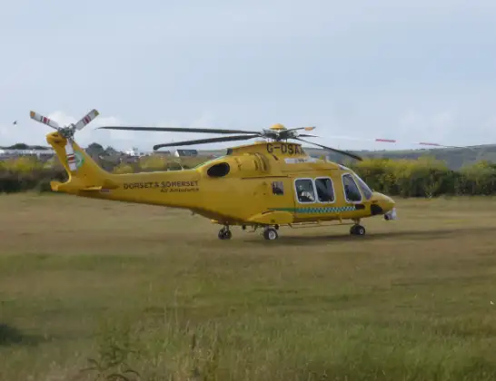
Helicopter: G-DSAA
The helicopter G-DSAA is used as a air ambulance helicopter. The main purpose of this aircraft is to transport a Mobile Medical Team to an incident as quickly as possible, enabling the trauma doctor to provide immediate first aid on site. The aircraft is flying this flight as Air Ambulance Helicopter.
Photo: Andrew Bone
24 miles
2175 feet
123 mph
12 minutes
08:09
08:20

Route
East Burton Road, 08:20
Wool08:20
Wareham08:19
Wool08:19
Wareham08:18
Wool08:18
Bovington08:17
Affpuddle and Turnerspuddle08:16
Burleston and Tolpuddle08:16
Milborne St Andrew08:15
Milton Abbas08:14
Milborne St Andrew08:14
Milton Abbas08:13
Woolland08:13
Ibberton08:12
Fifehead St Quintin08:11
Sturminster Newton08:10
Stalbridge, 08:09
Stalbridge08:09
Henstridge Airfield, Templecombe, Somerset08:09
Live flights
Today
Flights Wool
Air Ambulance Helicopter to Wool, Bovington Lane16 May 13:39
Helicopter flights on your website?
You can easily display helicopter flights on your own website. Use the embed code.
