Police Helicopter to Abergele, Gwibffordd Gogledd Cymru / North Wales Expressway
Thursday, 29 January 2026 | 19:30 | From Broughton
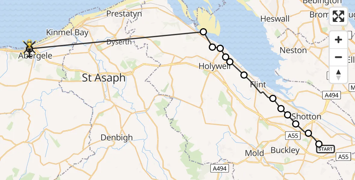
On Thursday, 29 January 2026 at 19:30, a Police Helicopter departed from Broughton to Abergele. It was the Police Helicopter with registration number G-POLG. The flight lasted 12 minutes. During that period, the aircraft travelled 29 miles at an average speed of 149 miles per hour at a maximum altitude of 2100 feet.
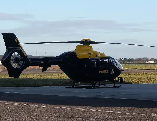
Helicopter: G-POLG
The helicopter G-POLG is used by the British police. The helicopter is deployed in pursuits, missing persons cases and other incidents where a helicopter provides added value.
Photo: Mike Burdett
29 miles
2100 feet
149 mph
12 minutes
19:30
19:42

Route
Gwibffordd Gogledd Cymru / North Wales Expressway, 19:42
Abergele19:42
Mostyn19:35
Holywell19:35
Greenfield19:34
Walwen19:34
Whelston19:34
Bagillt19:33
Flint19:32
Northop Hall19:32
Connah's Quay19:32
Wepre19:31
Aston19:31
Hawarden19:30
Chester Road, 19:30
Today
Police Helicopter to Epping Forest, Green Lane26 Feb 23:43
Flights Abergele
Flights Broughton
Police Helicopter to Broughton, Chester Road28 Jan 22:07
to Preston, Methuen Avenue28 Jan 16:21
Police Helicopter to Broughton, Broughton22 Jan 20:47
Helicopter flights on your website?
You can easily display helicopter flights on your own website. Use the embed code.
