Police Helicopter to MOD St Athan
Thursday, 29 January 2026 | 15:37 | From Llanover
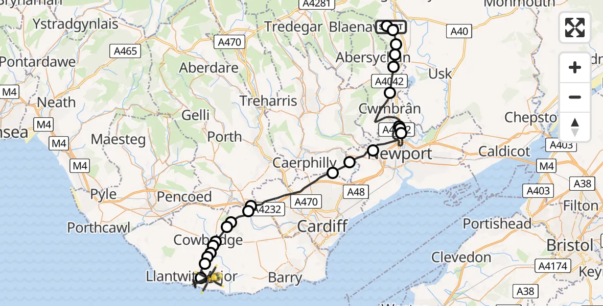
On Thursday, 29 January 2026 at 15:37, a Police Helicopter departed from Llanover to MOD St Athan. It was the Police Helicopter with registration number G-NWOI. The flight lasted 24 minutes. During that period, the aircraft travelled 47 miles at an average speed of 117 miles per hour at a maximum altitude of 1925 feet.

Helicopter: G-NWOI
The helicopter G-NWOI is used by the British police. The helicopter is deployed in pursuits, missing persons cases and other incidents where a helicopter provides added value.
Photo: James from Cheltenham
47 miles
1925 feet
117 mph
25 minutes
15:37
16:02

Route
MOD St Athan, St Athan, Vale of Glamorgan16:02
Boverton16:01
Llanmaes16:00
St Mary Church16:00
Llandough16:00
Cowbridge with Llanblethian15:59
Cowbridge15:59
Aberthin15:58
Ystradowen15:58
Pendoylan15:57
Peterston-super-Ely15:57
Cardiff15:54
Rudry15:53
Rhiwderin, Newport15:52
Newport15:45
Cwmbrân15:45
Ponthir15:44
Cwmbrân15:41
Pontypool15:40
Mamhilad15:39
Goetre Fawr15:39
Llanover15:38
Goetre Fawr15:38
Llanover, 15:37
Today
Flights Llanover
Air Ambulance Helicopter to Cardiff Heliport10 May 10:16
Air Ambulance Helicopter to Llanover10 May 08:32
Police Helicopter to MOD St Athan29 Jan 15:37
Police Helicopter to Llanover29 Jan 15:20
Police Helicopter to Llanover, Usk Road29 Jan 14:42
Helicopter flights on your website?
You can easily display helicopter flights on your own website. Use the embed code.
