Police Helicopter to Newcastle upon Tyne, Rosebrough Road
Thursday, 29 January 2026 | 8:10 | From Littletown
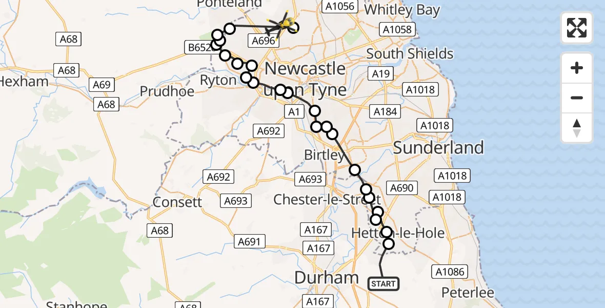
On Thursday, 29 January 2026 at 8:10, a Police Helicopter departed from Littletown to Newcastle upon Tyne. It was the Police Helicopter with registration number G-POLA. The flight lasted 11 minutes. During that period, the aircraft travelled 31 miles at an average speed of 174 miles per hour at a maximum altitude of 1600 feet.
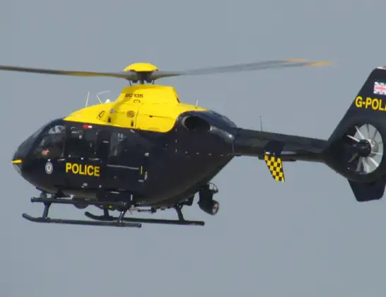
Helicopter: G-POLA
The helicopter G-POLA is used by the British police. The helicopter is deployed in pursuits, missing persons cases and other incidents where a helicopter provides added value.
Photo: ozz13x
32 miles
1600 feet
174 mph
11 minutes
08:10
08:21

Route
Rosebrough Road, North East08:21
Newcastle upon Tyne, North East08:20
Callerton, Newcastle upon Tyne08:20
Ponteland, North East08:19
Heddon-on-the-Wall, North East08:19
Blucher, Newcastle upon Tyne08:19
Throckley, Newcastle upon Tyne08:19
Walbottle, Newcastle upon Tyne08:18
Blucher, Newcastle upon Tyne08:17
Newcastle upon Tyne, North East08:17
Blaydon on Tyne, North East08:16
Newcastle upon Tyne, North East08:16
Whickham, North East08:15
Gateshead, North East08:15
Birtley, North East08:14
Gateshead, North East08:14
Lamesley, Birtley08:14
Washington, Sunderland08:13
Penshaw, Sunderland08:12
Fence Houses, Sunderland08:12
Chilton Moor, Sunderland08:12
High Dubmire, Sunderland08:12
East Rainton, Sunderland08:11
Hetton-le-Hole, Sunderland08:11
Pennine View, North East08:10
Live flights
Police Helicopter on its way from Renfrew15 Jul 23:02
Today
Police Helicopter to Coopersale, Epping Road15 Jul 23:07
Air Ambulance Helicopter to Dunkeswell Airfield15 Jul 23:01
Police Helicopter to Manchester Barton Aerodrome15 Jul 22:25
Police Helicopter to Baxterley Aerodrome15 Jul 22:24
Air Ambulance Helicopter to Henstridge Airfield15 Jul 22:14
Coastguard Helicopter to Argyll and Bute, B84515 Jul 22:05
Police Helicopter to MOD St Athan15 Jul 21:51
Flights Littletown
Helicopter flights on your website?
You can easily display helicopter flights on your own website. Use the embed code.
