Police Helicopter to Colebrook Village, Stoggy Lane
Wednesday, 28 January 2026 | 22:59 | From Plymouth
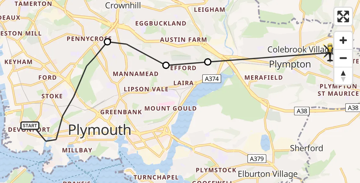
On Wednesday, 28 January 2026 at 22:59, a Police Helicopter departed from Plymouth to Colebrook Village. It was the Police Helicopter with registration number G-CPAS. The flight lasted 6 minutes. During that period, the aircraft travelled 7 miles at an average speed of 69 miles per hour at a maximum altitude of 3175 feet.

Helicopter: G-CPAS
The helicopter G-CPAS is used by the British police. The helicopter is deployed in pursuits, missing persons cases and other incidents where a helicopter provides added value.
8 miles
3175 feet
69 mph
7 minutes
22:59
23:05

Route
Stoggy Lane, Plymouth23:05
Plympton, Plymouth23:04
Plymouth23:04
Crownhill, Plymouth23:03
Raglan Road, 22:59
Live flights
Today
Flights Plymouth
Police Helicopter to Plymouth, Holne Chase4 Mar 21:19
Helicopter flights on your website?
You can easily display helicopter flights on your own website. Use the embed code.
