Air Ambulance Helicopter to Limpsfield, Broom Hill
Wednesday, 28 January 2026 | 15:17 | From Redhill Aerodrome
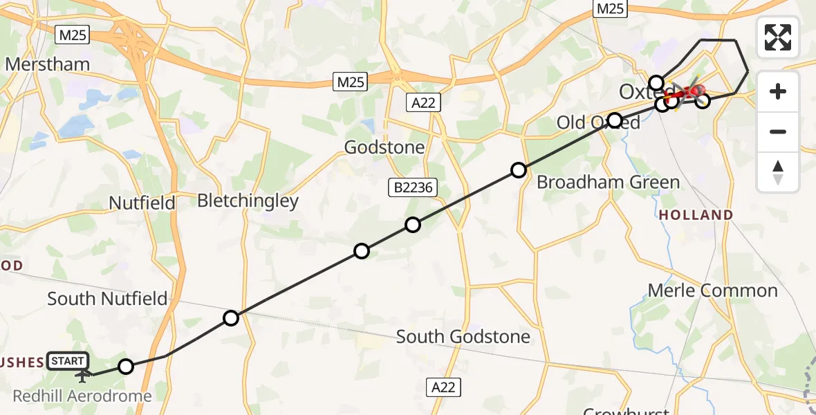
On Wednesday, 28 January 2026 at 15:17, a Air Ambulance Helicopter departed from Redhill Aerodrome to Limpsfield. It was the Air Ambulance Helicopter with registration number G-LNAC. The flight lasted 8 minutes. During that period, the aircraft travelled 10 miles at an average speed of 78 miles per hour at a maximum altitude of 1725 feet.
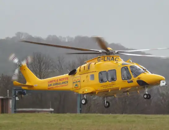
Helicopter: G-LNAC
The helicopter G-LNAC is used as a air ambulance helicopter. The main purpose of this aircraft is to transport a Mobile Medical Team to an incident as quickly as possible, enabling the trauma doctor to provide immediate first aid on site. The aircraft is flying this flight as Air Ambulance Helicopter.
Photo: James from Cheltenham, Gloucestershire
10 miles
1725 feet
78 mph
8 minutes
15:17
15:24

Route
Broom Hill, 15:24
Limpsfield15:24
Limpsfield, Oxted15:24
Limpsfield15:22
Limpsfield, Oxted15:22
Old Oxted, Oxted15:22
Old Oxted15:21
Godstone15:21
Bletchingley15:20
Tandridge15:20
South Nutfield15:19
Redhill Aerodrome, Redhill, Surrey15:18
Redhill Aerodrome, Redhill, Surrey15:17
Live flights
Today
Coastguard Drone to Dover, A203:03:07
Police Helicopter to East Ardsley, Stoney Lane13 Jun 23:37
Flights Limpsfield
Air Ambulance Helicopter to St Georges Hospital28 Jan 16:06
Helicopter flights on your website?
You can easily display helicopter flights on your own website. Use the embed code.
