Police Helicopter to Llandegla
Wednesday, 28 January 2026 | 14:41 | From Penycae
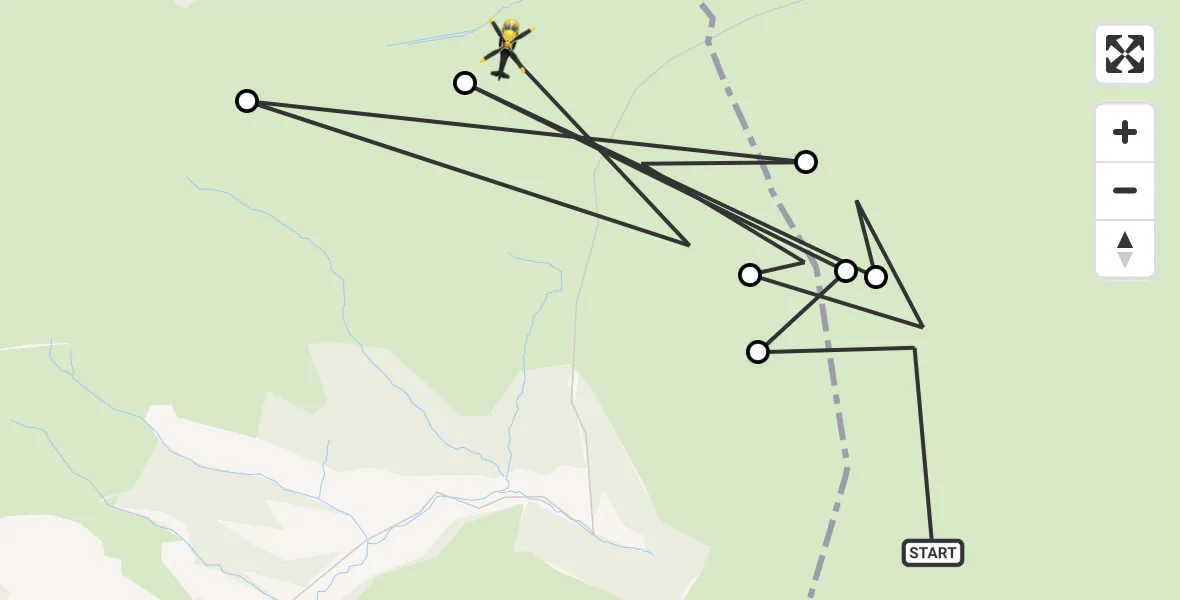
On Wednesday, 28 January 2026 at 14:41, a Police Helicopter departed from Penycae to Llandegla. It was the Police Helicopter with registration number G-POLG. The flight lasted 6 minutes. During that period, the aircraft travelled 8 miles at an average speed of 79 miles per hour at a maximum altitude of 2500 feet.
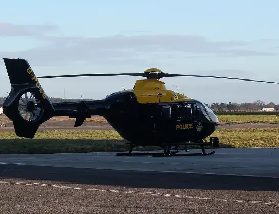
Helicopter: G-POLG
The helicopter G-POLG is used by the British police. The helicopter is deployed in pursuits, missing persons cases and other incidents where a helicopter provides added value.
Photo: Mike Burdett
9 miles
2500 feet
79 mph
7 minutes
14:41
14:47

Route
Llandegla, 14:47
Llandegla14:47
New Brighton14:45
Llandegla14:45
Penycae14:43
Llandegla14:43
Penycae14:42
Llandegla14:42
Penycae, 14:41
Live flights
Today
Flights Llandegla
Air Ambulance Helicopter to Llandegla13 Jun 17:48
Police Helicopter to Minera22 Apr 15:39
Police Helicopter to Llandegla22 Apr 15:17
Police Helicopter to Llandegla21 Mar 16:17
Flights Penycae
Police Helicopter to Hawarden Airport22 Apr 15:57
Police Helicopter to Llandegla28 Jan 14:41
Helicopter flights on your website?
You can easily display helicopter flights on your own website. Use the embed code.
