Police Helicopter to Wootton, Dornford Lane
Wednesday, 28 January 2026 | 14:02 | From Combe
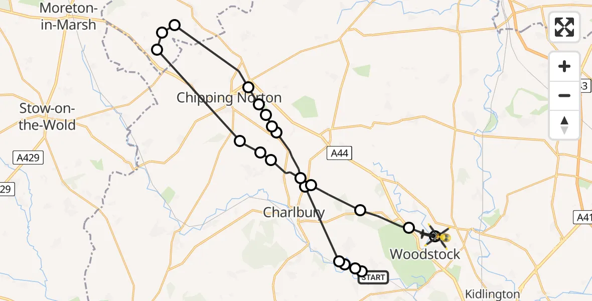
On Wednesday, 28 January 2026 at 14:02, a Police Helicopter departed from Combe to Wootton. It was the Police Helicopter with registration number G-POLC. The flight lasted 14 minutes. During that period, the aircraft travelled 29 miles at an average speed of 123 miles per hour at a maximum altitude of 2000 feet.
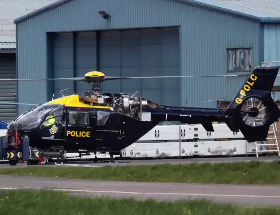
Helicopter: G-POLC
The helicopter G-POLC is used by the British police. The helicopter is deployed in pursuits, missing persons cases and other incidents where a helicopter provides added value.
Photo: James
30 miles
2000 feet
123 mph
15 minutes
14:02
14:16

Route
Dornford Lane, Woodstock14:16
Wootton, Woodstock14:16
Wootton, West Oxfordshire14:16
West Oxfordshire14:15
Charlbury, West Oxfordshire14:14
Spelsbury, West Oxfordshire14:13
Chadlington, Charlbury14:13
Chadlington, Chipping Norton14:12
Little Compton, Stratford-on-Avon14:10
Barton-on-the-Heath, Stratford-on-Avon14:09
Stratford-on-Avon14:09
Over Norton, West Oxfordshire14:07
Chipping Norton, West Oxfordshire14:07
Enstone, Chipping Norton14:07
Chipping Norton, West Oxfordshire14:07
West Oxfordshire14:06
Spelsbury, West Oxfordshire14:05
Charlbury, West Oxfordshire14:05
Oaklands Farm Airstrip, Witney, Oxfordshire14:03
Stonesfield, West Oxfordshire14:03
East End, West Oxfordshire14:02
West Oxfordshire14:02
Horns Lane, West Oxfordshire14:02
Live flights
Today
Flights Wootton
Police Helicopter to Kidlington, Woodstock Road10 Jul 14:44
Police Helicopter to Wootton, Dornford Lane28 Jan 14:02
Police Helicopter to Shipton-on-Cherwell22 Jan 15:49
Flights Combe
Air Ambulance Helicopter to Combe24 Apr 08:47
Air Ambulance Helicopter to Oxford, Headley Way18 Apr 18:14
Air Ambulance Helicopter to Combe, Mud lane18 Apr 17:07
Air Ambulance Helicopter to Combe, Mud lane18 Apr 16:47
Police Helicopter to Wootton, Dornford Lane28 Jan 14:02
Police Helicopter to Tackley, B402723 Jan 15:37
Police Helicopter to Almondsbury Helicopter Base16 Jan 15:01
Helicopter flights on your website?
You can easily display helicopter flights on your own website. Use the embed code.
