Air Ambulance Helicopter to Dafen, B4303
Wednesday, 28 January 2026 | 12:59 | From Crundale
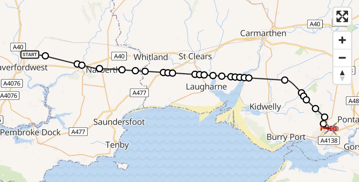
On Wednesday, 28 January 2026 at 12:59, a Air Ambulance Helicopter departed from Crundale to Dafen. It was the Air Ambulance Helicopter with registration number G-WROL. The flight lasted 19 minutes. During that period, the aircraft travelled 38 miles at an average speed of 120 miles per hour at a maximum altitude of 2175 feet.

Helicopter: G-WROL
The helicopter G-WROL is used as a air ambulance helicopter. The main purpose of this aircraft is to transport a Mobile Medical Team to an incident as quickly as possible, enabling the trauma doctor to provide immediate first aid on site. The aircraft is flying this flight as Air Ambulance Helicopter.
Photo: James from Cheltenham, Gloucestershire
38 miles
2175 feet
120 mph
19 minutes
12:59
13:18

Route
B4303, 13:18
Felinfoel13:17
Swiss Valley13:16
Pum Heol / Five Roads13:16
Cynheidre13:15
Pont-iets13:15
Pont-henri13:14
Meinciau13:13
Llandyfaelog13:11
Ferryside13:11
Llansteffan13:11
Llanybri13:10
Llansteffan13:10
Llanybri13:10
Laugharne13:09
Laugharne Township13:09
St Clears13:08
Laugharne13:08
Llanddowror13:07
Red Roses13:07
Llanddowror13:06
Whitland13:05
Tavernspite13:05
Lampeter Velfrey13:04
Narberth13:03
Robeston Wathen13:02
Llawhaden13:02
Wiston, 13:00
Crundale12:59
Live flights
Today
Flights Dafen
Air Ambulance Helicopter to Dafen, Heol Aur13 Jul 18:27
Air Ambulance Helicopter to Barry, Waycock Road13 Jul 14:28
Air Ambulance Helicopter to Dafen, Heol Aur13 Jul 12:46
Air Ambulance Helicopter to Cray13 Jul 10:03
Air Ambulance Helicopter to Dafen, Heol Aur12 Jul 16:00
Air Ambulance Helicopter to Nantmel, A4412 Jul 13:50
Air Ambulance Helicopter to Dafen, Heol Aur12 Jul 08:18
Air Ambulance Helicopter to Dafen, Heol Aur11 Jul 18:18
Air Ambulance Helicopter to Llywel11 Jul 15:17
Air Ambulance Helicopter to Dafen, Heol Aur11 Jul 11:03
Flights Crundale
Air Ambulance Helicopter to Dafen, B430328 Jan 12:59
Helicopter flights on your website?
You can easily display helicopter flights on your own website. Use the embed code.
