Police Helicopter to MOD St Athan
Tuesday, 27 January 2026 | 19:48 | From MOD St Athan
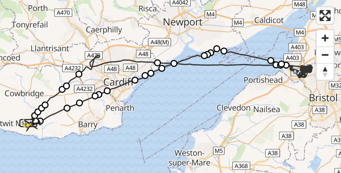
On Tuesday, 27 January 2026 at 19:48, a Police Helicopter departed from MOD St Athan to MOD St Athan. It was the Police Helicopter with registration number G-NWOI. The flight lasted 92 minutes. During that period, the aircraft travelled 137 miles at an average speed of 90 miles per hour at a maximum altitude of 2425 feet.

Helicopter: G-NWOI
The helicopter G-NWOI is used by the British police. The helicopter is deployed in pursuits, missing persons cases and other incidents where a helicopter provides added value.
Photo: James from Cheltenham
137 miles
2425 feet
90 mph
92 minutes
19:48
21:20

Route
MOD St Athan, St Athan, Vale of Glamorgan21:20
MOD St Athan, St Athan, Vale of Glamorgan21:20
St Athan21:20
Llancarfan21:18
Dyffryn21:17
Wenvoe21:16
Michaelston-le-Pit21:16
Michaelston-le-Pit and Leckwith21:15
Cardiff21:14
Trowbridge21:13
Cardiff21:13
Newport21:12
Bristol Channel21:09
Goldcliff, Newport21:09
Newport21:09
Whitson, Newport21:08
Newport21:08
Bristol Channel21:05
Pill and Easton-in-Gordano21:04
Bristol, West of England20:04
Pill and Easton-in-Gordano20:04
Bristol, West of England20:03
Bristol Channel19:59
Newport19:58
Cardiff19:52
Peterston-super-Ely19:51
Pendoylan19:51
Bonvilston19:49
Flemingston19:49
Llanfair19:49
Flemingston19:49
MOD St Athan, St Athan, Vale of Glamorgan19:48
Live flights
Today
Helicopter flights on your website?
You can easily display helicopter flights on your own website. Use the embed code.
