Police Helicopter to Kingsteignton, Gappah Lane
Tuesday, 27 January 2026 | 16:14 | From Clyst St Mary
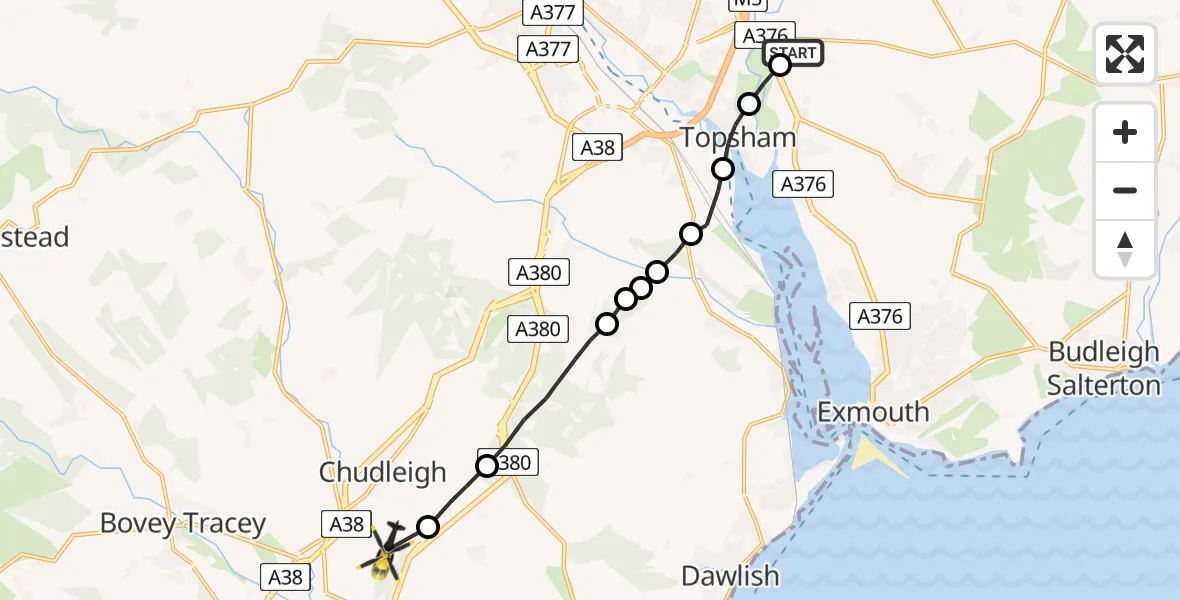
On Tuesday, 27 January 2026 at 16:14, a Police Helicopter departed from Clyst St Mary to Kingsteignton. It was the Police Helicopter with registration number G-CPAS. The flight lasted 6 minutes. During that period, the aircraft travelled 11 miles at an average speed of 102 miles per hour at a maximum altitude of 2425 feet.
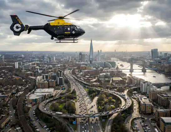
Helicopter: G-CPAS
The helicopter G-CPAS is used by the British police. The helicopter is deployed in pursuits, missing persons cases and other incidents where a helicopter provides added value.
11 miles
2425 feet
102 mph
7 minutes
16:14
16:21

Route
Gappah Lane, Teignbridge16:21
Ideford, Teignbridge16:20
Chudleigh, Teignbridge16:20
Teignbridge, Devon and Torbay16:18
Kenn, Teignbridge16:18
Teignbridge, Devon and Torbay16:17
Kenton, Teignbridge16:17
Teignbridge, Devon and Torbay16:17
Exminster, Teignbridge16:16
Topsham, Exeter16:15
Clyst St. George, East Devon16:15
Church Lane, East Devon16:14
Live flights
Police Helicopter on its way from RAF Benson12 Jul 22:54
Police Helicopter on its way from Dundrod12 Jul 22:50
Police Helicopter on its way from East Ardsley12 Jul 22:44
Today
Air Ambulance Helicopter to Glasgow Airport12 Jul 22:48
Air Ambulance Helicopter to Norwich Airport12 Jul 22:27
Air Ambulance Helicopter to Northrepps Aerodrome12 Jul 22:23
Police Helicopter to Harborough, Sulby Road12 Jul 22:20
Air Ambulance Helicopter to Derriford Hospital12 Jul 22:12
Police Helicopter to Manchester Barton Aerodrome12 Jul 22:11
Air Ambulance Helicopter to Northrepps Aerodrome12 Jul 22:03
Flights Kingsteignton
Police Helicopter to Exeter, M519 Mar 18:28
Police Helicopter to Ideford Combe, A38019 Mar 17:54
Police Helicopter to Kingsteignton, Gappah Lane27 Jan 16:14
Helicopter flights on your website?
You can easily display helicopter flights on your own website. Use the embed code.
