Coastguard Helicopter to Caernarfon Airport
Monday, 26 January 2026 | 18:20 | From Tudweiliog
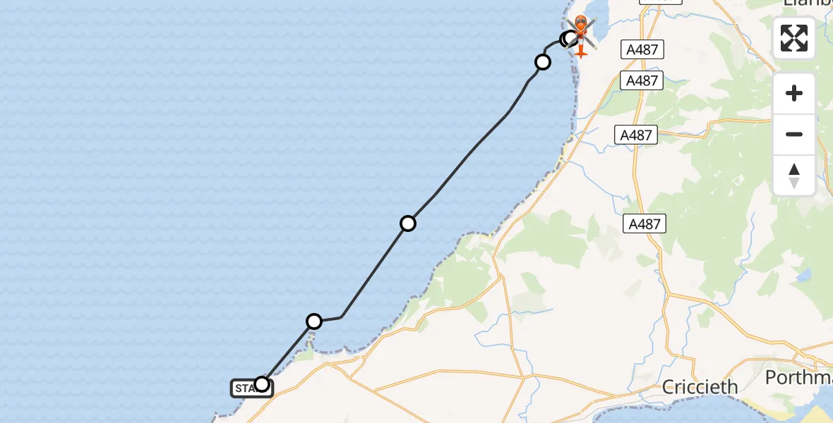
On Monday, 26 January 2026 at 18:20, a Coastguard Helicopter departed from Tudweiliog to Caernarfon Airport. It was the Coastguard Helicopter with registration number G-MCGZ. The flight lasted 35 minutes. During that period, the aircraft travelled 18 miles at an average speed of 31 miles per hour at a maximum altitude of 950 feet.
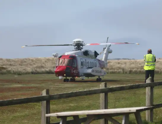
Helicopter: G-MCGZ
The helicopter G-MCGZ is used by the British Coastguard. The helicopter is deployed in search and rescue operations at sea, rescue operations involving ships or drilling platforms, patrols to prevent smuggling or piracy, environmental monitoring and disaster relief support.
Photo: Andrewrabbott
18 miles
950 feet
31 mph
35 minutes
18:20
18:54

Route
Caernarfon Airport, Caernarfon18:54
Caernarfon Airport, Caernarfon18:32
Caernarfon Airport, Caernarfon18:30
Caernarfon Airport, Caernarfon18:29
Llanfaglan18:29
Dinas Dinlle18:28
Irish Sea18:24
Morfa Nefyn18:21
Nefyn18:20
Tudweiliog, 18:20
Live flights
Police Helicopter on its way from Thames View14 Jul 22:44
Police Helicopter on its way from Brandy Carr14 Jul 22:00
Today
Air Ambulance Helicopter to Cardiff Heliport14 Jul 22:43
Coastguard Helicopter to North Sea14 Jul 22:40
Air Ambulance Helicopter to North Sea14 Jul 22:27
Air Ambulance Helicopter to Priory Farm Airstrip14 Jul 22:16
Air Ambulance Helicopter to Papworth Hospital14 Jul 22:02
Air Ambulance Helicopter to Redhill Aerodrome14 Jul 21:58
Coastguard Helicopter to North Sea14 Jul 21:56
Flights Tudweiliog
Coastguard Helicopter to Caernarfon Airport26 Jan 18:20
Coastguard Helicopter to Tudweiliog26 Jan 18:11
Coastguard Helicopter to Tudweiliog26 Jan 17:54
Helicopter flights on your website?
You can easily display helicopter flights on your own website. Use the embed code.
