Air Ambulance Helicopter to Inverness, Ashton Road
Monday, 26 January 2026 | 16:37 | From Cannich
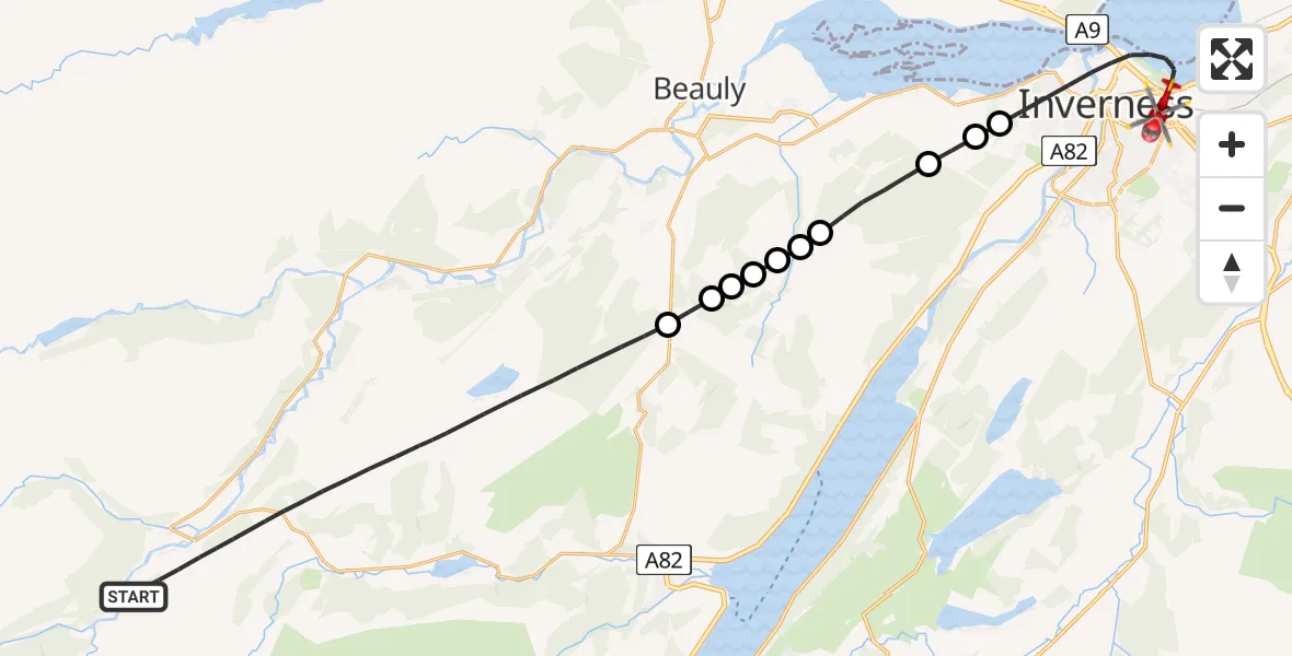
On Monday, 26 January 2026 at 16:37, a Air Ambulance Helicopter departed from Cannich to Inverness. It was the Air Ambulance Helicopter with registration number G-GSAS. The flight lasted 14 minutes. During that period, the aircraft travelled 27 miles at an average speed of 117 miles per hour at a maximum altitude of 3300 feet.
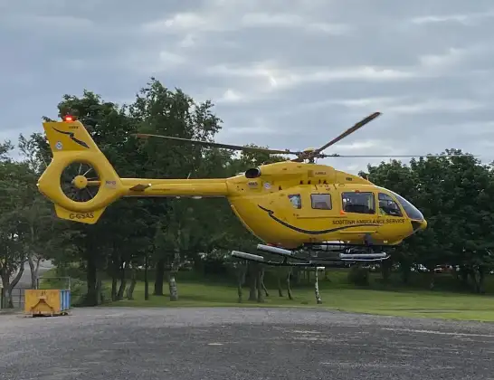
Helicopter: G-GSAS
The helicopter G-GSAS is used as a air ambulance helicopter. The main purpose of this aircraft is to transport a Mobile Medical Team to an incident as quickly as possible, enabling the trauma doctor to provide immediate first aid on site. The aircraft is flying this flight as Air Ambulance Helicopter.
Photo: Scanbus
27 miles
3300 feet
117 mph
14 minutes
16:37
16:51

Route
Ashton Road, 16:51
Inverness16:47
Kirkhill and Bunchrew16:47
Inverness16:47
Kirkhill and Bunchrew16:45
Inverness16:45
Kirkhill and Bunchrew16:45
Beauly16:45
Teavarran16:44
Foxhole16:44
Kiltarlity16:44
Cannich16:37
16:37
Today
Police Helicopter to Epping Forest, Green Lane26 Feb 23:43
Flights Inverness
Air Ambulance Helicopter to Tornagrain, A9626 Feb 16:30
Air Ambulance Helicopter to Inverness, Inverness25 Feb 18:37
Air Ambulance Helicopter to Inverness, Inverness25 Feb 11:59
Flights Cannich
Coastguard Helicopter to Tomich, Cannich17 Jan 16:46
Helicopter flights on your website?
You can easily display helicopter flights on your own website. Use the embed code.
