Air Ambulance Helicopter to Cannich, Old Military Road
Monday, 26 January 2026 | 9:55 | From Ardersier
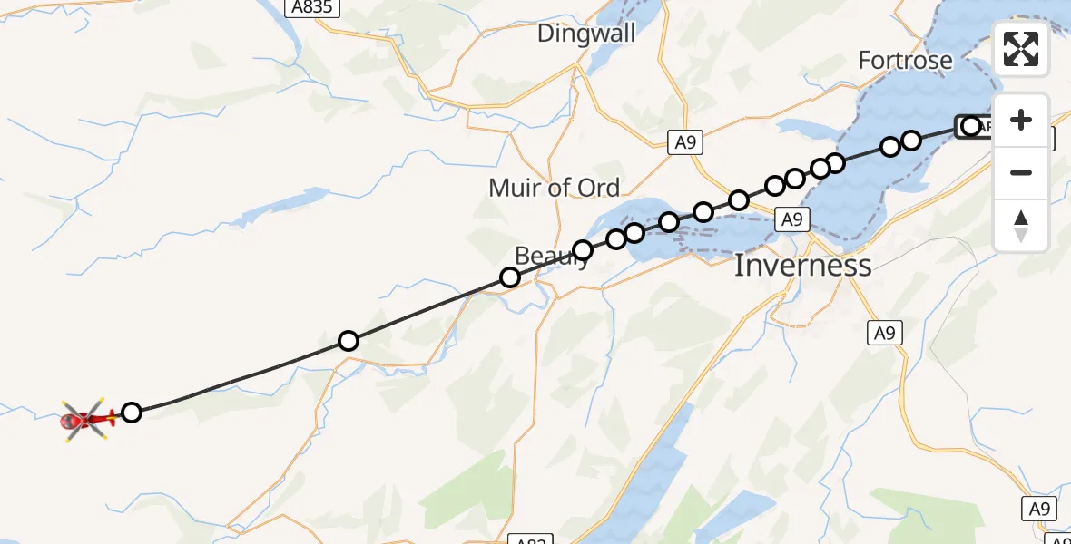
On Monday, 26 January 2026 at 9:55, a Air Ambulance Helicopter departed from Ardersier to Cannich. It was the Air Ambulance Helicopter with registration number G-GSAS. The flight lasted 13 minutes. During that period, the aircraft travelled 33 miles at an average speed of 156 miles per hour at a maximum altitude of 2450 feet.
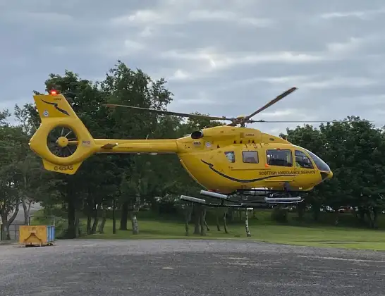
Helicopter: G-GSAS
The helicopter G-GSAS is used as a air ambulance helicopter. The main purpose of this aircraft is to transport a Mobile Medical Team to an incident as quickly as possible, enabling the trauma doctor to provide immediate first aid on site. The aircraft is flying this flight as Air Ambulance Helicopter.
Photo: Scanbus
33 miles
2450 feet
156 mph
13 minutes
09:55
10:08

Route
10:08
Cannich10:07
Struy10:04
Kilmorack10:02
Beauly10:01
Kirkhill and Bunchrew10:00
Inchmore10:00
Inverness10:00
Charleston09:59
Inverness09:59
Charleston09:58
Inverness09:58
Kilmuir09:57
Inverness09:57
Avoch09:56
Fortrose09:56
Inverness09:55
Old Military Road, 09:55
Live flights
Police Helicopter on its way from Ewelme13 Jul 22:24
Today
Police Helicopter to Manchester Barton Aerodrome13 Jul 23:56
Police Helicopter to Bournemouth Airport13 Jul 23:55
Air Ambulance Helicopter to Cardiff Heliport13 Jul 23:38
Police Helicopter to Birmingham Airport13 Jul 23:21
Police Helicopter to Irlam, Twelve Yards Road13 Jul 23:00
Flights Cannich
Coastguard Helicopter to Cannich, A8315 May 09:44
Coastguard Helicopter to Tomich, Cannich17 Jan 16:46
Flights Ardersier
Air Ambulance Helicopter to Highland11 Jul 11:02
Air Ambulance Helicopter to Scatinan, Searchlight Emplacement (Second World War) - Twartquoy9 Jul 12:46
Coastguard Helicopter to Inverness Airport9 Jul 11:59
Air Ambulance Helicopter to Edderton7 Jul 10:25
Air Ambulance Helicopter to North Sea5 Jul 20:29
Air Ambulance Helicopter to Loch Luichart1 Jul 14:53
Air Ambulance Helicopter to Ardersier29 Jun 12:34
Air Ambulance Helicopter to Inverness Airport29 Jun 08:50
Coastguard Helicopter to Inverness Airport25 Jun 16:01
Helicopter flights on your website?
You can easily display helicopter flights on your own website. Use the embed code.
