Air Ambulance Helicopter to Weymouth, Knightsdale Road
Monday, 26 January 2026 | 14:32 | From Stalbridge
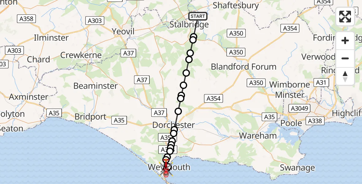
On Monday, 26 January 2026 at 14:32, a Air Ambulance Helicopter departed from Stalbridge to Weymouth. It was the Air Ambulance Helicopter with registration number G-DSAA. The flight lasted 14 minutes. During that period, the aircraft travelled 29 miles at an average speed of 120 miles per hour at a maximum altitude of 1625 feet.
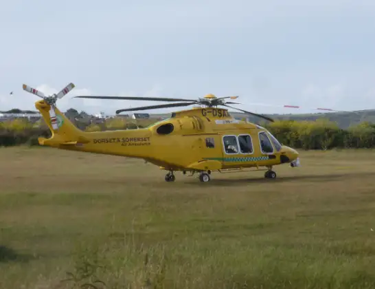
Helicopter: G-DSAA
The helicopter G-DSAA is used as a air ambulance helicopter. The main purpose of this aircraft is to transport a Mobile Medical Team to an incident as quickly as possible, enabling the trauma doctor to provide immediate first aid on site. The aircraft is flying this flight as Air Ambulance Helicopter.
Photo: Andrew Bone
29 miles
1625 feet
120 mph
15 minutes
14:32
14:46

Route
Knightsdale Road, 14:46
Weymouth14:44
Wyke Regis, Weymouth14:44
Weymouth14:43
Nottington, Weymouth14:43
Weymouth14:42
Upwey, Weymouth14:42
Bincombe14:42
Winterborne Came14:42
Winterborne Herringston14:41
Dorchester14:41
Stinsford14:39
Piddlehinton14:38
White Lackington14:38
Piddletrenthide14:37
Plush14:36
Mappowder14:35
Hazelbury Bryan14:35
Lydlinch14:34
Sturminster Newton14:34
Stalbridge, 14:32
Stalbridge14:32
Live flights
Today
Police Helicopter to Epping Forest, Green Lane26 Feb 23:43
Flights Weymouth
Police Helicopter to Weymouth, Hampshire Road10 Feb 11:19
Flights Stalbridge
Air Ambulance Helicopter to St Marys Hospital Isle Of Wight, St Marys Hospital Isle Of Wight28 Jan 17:28
Helicopter flights on your website?
You can easily display helicopter flights on your own website. Use the embed code.
