Coastguard Helicopter to Ffestiniog, Quarry Incline
Sunday, 25 January 2026 | 16:06 | From Caernarfon Airport
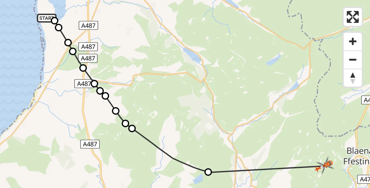
On Sunday, 25 January 2026 at 16:06, a Coastguard Helicopter departed from Caernarfon Airport to Ffestiniog. It was the Coastguard Helicopter with registration number G-MCGZ. The flight lasted 23 minutes. During that period, the aircraft travelled 18 miles at an average speed of 49 miles per hour at a maximum altitude of 2700 feet.
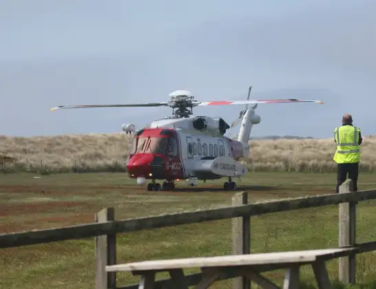
Helicopter: G-MCGZ
The helicopter G-MCGZ is used by the British Coastguard. The helicopter is deployed in search and rescue operations at sea, rescue operations involving ships or drilling platforms, patrols to prevent smuggling or piracy, environmental monitoring and disaster relief support.
Photo: Andrewrabbott
19 miles
2700 feet
49 mph
23 minutes
16:06
16:29

Route
Quarry Incline, 16:29
Nantmor16:22
Dolbenmaen16:20
Clynnog16:19
Llanllyfni16:19
Tal-y-sarn16:18
Llanllyfni16:18
Tal-y-sarn16:18
Pen-y-groes16:17
Y Groeslon16:17
Llandwrog16:17
Dinas Dinlle16:16
Llanfaglan16:16
Caernarfon Airport, Caernarfon16:15
Caernarfon Airport, Caernarfon16:06
Live flights
Police Helicopter on its way from RAF Benson12 Jul 22:54
Police Helicopter on its way from Dundrod12 Jul 22:50
Today
Air Ambulance Helicopter to Glasgow Airport12 Jul 22:48
Police Helicopter to Walton Wood Airfield12 Jul 22:44
Air Ambulance Helicopter to Norwich Airport12 Jul 22:27
Air Ambulance Helicopter to Northrepps Aerodrome12 Jul 22:23
Flights Ffestiniog
Helicopter flights on your website?
You can easily display helicopter flights on your own website. Use the embed code.
