Air Ambulance Helicopter to Staffordshire Moorlands, Limes Avenue
Saturday, 24 January 2026 | 16:26 | From Chinley
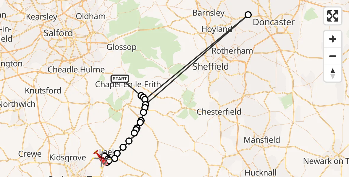
On Saturday, 24 January 2026 at 16:26, a Air Ambulance Helicopter departed from Chinley to Staffordshire Moorlands. It was the Air Ambulance Helicopter with registration number G-DRLA. The flight lasted 13 minutes. During that period, the aircraft travelled 93 miles at an average speed of 445 miles per hour at a maximum altitude of 2700 feet.
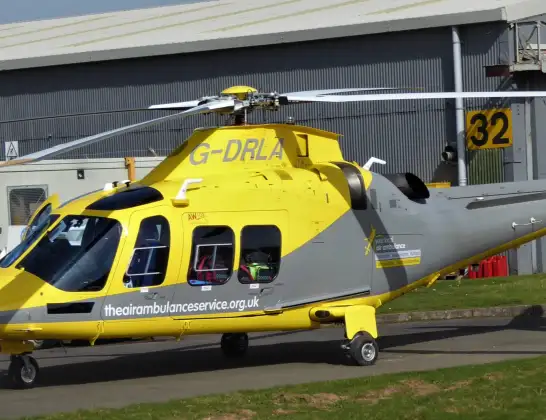
Helicopter: G-DRLA
The helicopter G-DRLA is used as an ambulance helicopter. The helicopter is equipped with a stretcher for transporting patients. The helicopter is often used to transport to hospitals.
Photo: Alec Wilson
93 miles
2700 feet
445 mph
13 minutes
16:26
16:39

Route
Limes Avenue, 16:39
Leek, Staffordshire Moorlands16:39
Cheddleton, Leek16:38
Leek, Staffordshire Moorlands16:38
Cheddleton, Leek16:38
Cheddleton, Staffordshire Moorlands16:37
Staffordshire Moorlands16:37
Leek, Staffordshire Moorlands16:36
Cheddleton, Leek16:36
Bradnop, Staffordshire Moorlands16:35
Thorncliffe, Staffordshire Moorlands16:34
Staffordshire Moorlands16:34
Fawfieldhead, Staffordshire Moorlands16:33
Staffordshire Moorlands16:33
Longnor, Staffordshire Moorlands16:32
Earl Sterndale, Derbyshire Dales16:32
High Peak, East Midlands16:31
Chelmorton CP, Derbyshire Dales16:31
Blackwell in the Peak CP, Derbyshire Dales16:31
Tunstead, High Peak16:30
Hickleton, Doncaster16:30
Wormhill, High Peak16:30
Tunstead, High Peak16:30
Peak Dale, High Peak16:29
Over Hill Road, High Peak16:26
Live flights
Police Helicopter on its way from Wrenthorpe15 Jul 23:36
Flights Chinley
Helicopter flights on your website?
You can easily display helicopter flights on your own website. Use the embed code.
