Air Ambulance Aircraft to Inner Seas
Friday, 23 January 2026 | 20:08 | From Aberdeen International Airport
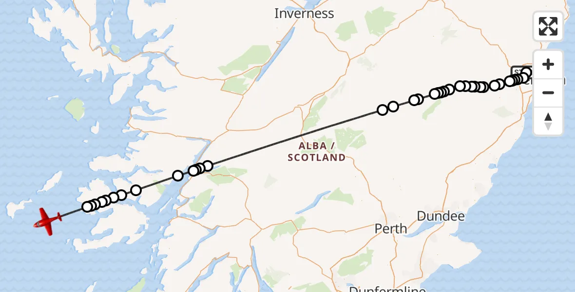
On Friday, 23 January 2026 at 20:08, a Air Ambulance Aircraft departed from Aberdeen International Airport to Inner Seas. It was the Air Ambulance Aircraft with registration number G-SASD. The flight lasted 36 minutes. During that period, the aircraft travelled 177 miles at an average speed of 294 miles per hour at a maximum altitude of 16025 feet.
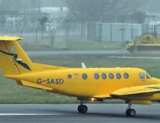
Helicopter: G-SASD
The aircraft G-SASD is used as an air ambulance aircraft. The main purpose of this aircraft is to transport a Mobile Medical Team to an incident as quickly as possible, enabling the trauma doctor to provide immediate first aid on site. The aircraft is flying this flight as Air Ambulance Aircraft.
Photo: Albert Bridge
177 miles
16025 feet
294 mph
37 minutes
20:08
20:44

Route
Inner Seas, 20:44
Inner Seas20:41
Ballygown20:41
Kilbrennan20:40
Dervaig20:40
Aros Bridge20:40
Aros20:39
Inner Seas20:39
Loch Arienas20:38
Ardgour20:35
Inner Seas20:34
Onich20:33
North Ballachulish20:33
Glencoe20:33
Claybokie20:21
Braemar20:20
Crathie20:18
Mains of Abergeldie20:18
Ballater20:17
Tullich20:17
Cambus o' May20:16
Milton of Logie20:16
Ordie20:16
Tarland20:15
Aboyne20:14
Lumphanan20:14
Kincardine O'Neil20:13
Torphins20:13
Campfield20:13
Banchory20:12
Echt20:11
Garlogie20:10
Elrick20:10
Elrick, Westhill20:10
Aberdeen City20:09
Kingswells, Aberdeen City20:09
Aberdeen City20:08
Wellheads Drive, 20:08
Live flights
Today
Helicopter flights on your website?
You can easily display helicopter flights on your own website. Use the embed code.
