Air Ambulance Helicopter to North Weald Airfield
Friday, 23 January 2026 | 18:57 | From Stanford-le-Hope
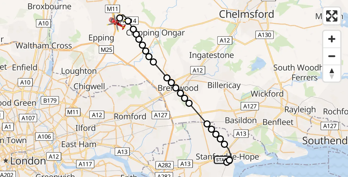
On Friday, 23 January 2026 at 18:57, a Air Ambulance Helicopter departed from Stanford-le-Hope to North Weald Airfield. It was the Air Ambulance Helicopter with registration number G-EHAT. The flight lasted 10 minutes. During that period, the aircraft travelled 22 miles at an average speed of 126 miles per hour at a maximum altitude of 1925 feet.
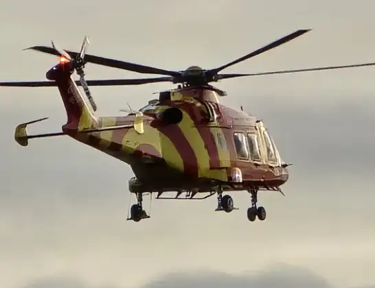
Helicopter: G-EHAT
The helicopter G-EHAT is used as a air ambulance helicopter. The main purpose of this aircraft is to transport a Mobile Medical Team to an incident as quickly as possible, enabling the trauma doctor to provide immediate first aid on site. The aircraft is flying this flight as Air Ambulance Helicopter.
Photo: By Steve Knight
22 miles
1925 feet
126 mph
11 minutes
18:57
19:08

Route
North Weald Airfield, Epping, Essex19:08
North Weald Airfield, Epping, Essex19:06
North Weald Bassett, Epping Forest19:05
Epping Forest, Essex19:05
Greensted Green, Epping Forest19:05
Toot Hill, Epping Forest19:04
Stanford Rivers, Epping Forest19:04
Little End, Epping Forest19:04
Brentwood, Essex19:04
Kelvedon Hatch, Brentwood19:03
Coxtie Green, Brentwood19:03
Pilgrims' Hatch, Brentwood19:02
South Weald, Brentwood19:02
Brentwood, Essex19:02
Little Warley, Brentwood19:02
Ingrave, Brentwood19:01
West Horndon, Brentwood19:00
Bulphan, Thurrock19:00
Thurrock19:00
Stanford-le-Hope, Thurrock19:00
Horndon On The Hill, Thurrock18:59
Stanford-le-Hope, Thurrock18:59
Mucking, Thurrock18:58
Delamare Close, Thurrock18:57
Live flights
Air Ambulance Helicopter on its way from Ashford14 Jul 23:46
Coastguard Helicopter on its way from North Sea14 Jul 23:44
Today
Police Helicopter to Johnstone, Gordon Square14 Jul 23:38
Coastguard Helicopter to North Sea14 Jul 23:30
Police Helicopter to Inner Seas14 Jul 23:12
Air Ambulance Helicopter to Norwich Airport14 Jul 22:52
Police Helicopter to Manchester Barton Aerodrome14 Jul 22:50
Police Helicopter to Sewardstonebury, Bury Road14 Jul 22:44
Air Ambulance Helicopter to Cardiff Heliport14 Jul 22:43
Flights Stanford-le-Hope
Air Ambulance Helicopter to North Weald Airfield27 Mar 15:05
Air Ambulance Helicopter to North Weald Airfield23 Jan 18:57
Helicopter flights on your website?
You can easily display helicopter flights on your own website. Use the embed code.
