Police Helicopter to Shipton-on-Cherwell, Upper Campsfield Road
Thursday, 22 January 2026 | 11:09 | From Charlbury
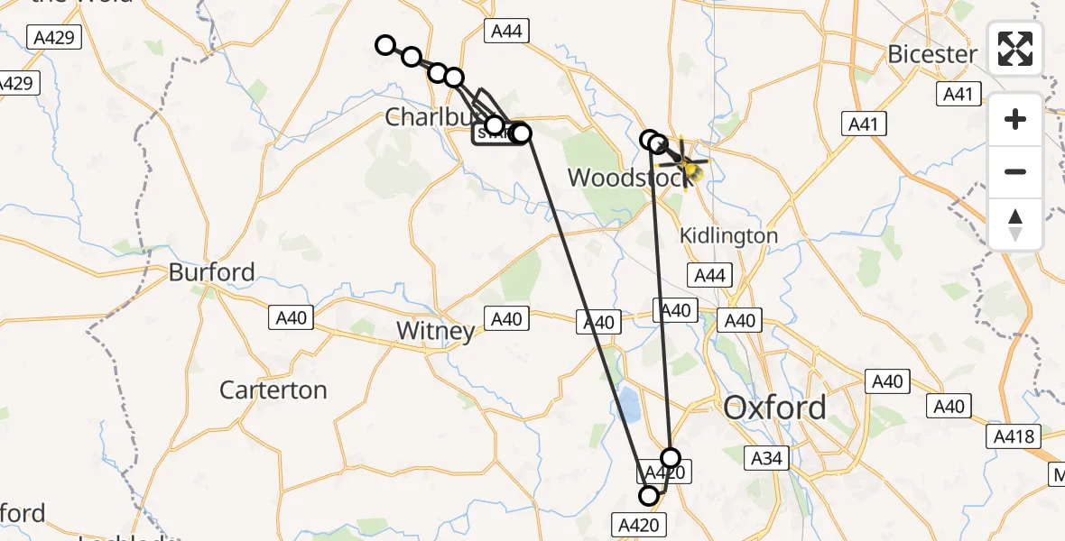
On Thursday, 22 January 2026 at 11:09, a Police Helicopter departed from Charlbury to Shipton-on-Cherwell. It was the Police Helicopter with registration number G-POLC. The flight lasted 11 minutes. During that period, the aircraft travelled 36 miles at an average speed of 192 miles per hour at a maximum altitude of 1700 feet.
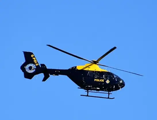
Helicopter: G-POLC
The helicopter G-POLC is used by the British police. The helicopter is deployed in pursuits, missing persons cases and other incidents where a helicopter provides added value.
Photo: Alec Wilson
37 miles
1700 feet
192 mph
12 minutes
11:09
11:20

Route
Upper Campsfield Road, Cherwell11:20
Tackley, West Oxfordshire11:20
Wootton, Woodstock11:20
Cumnor, Vale of White Horse11:19
Besselsleigh, Vale of White Horse11:19
Stonesfield, West Oxfordshire11:18
Charlbury, West Oxfordshire11:16
Stonesfield, West Oxfordshire11:15
Charlbury, West Oxfordshire11:14
Spelsbury, West Oxfordshire11:13
Chadlington, Chipping Norton11:13
Spelsbury, West Oxfordshire11:11
B4437, West Oxfordshire11:09
Live flights
Today
Flights Shipton-on-Cherwell
Flights Charlbury
Police Helicopter to Charlbury, Saltway6 Jul 15:03
Police Helicopter to Charlbury, Forest Road24 Apr 15:06
Helicopter flights on your website?
You can easily display helicopter flights on your own website. Use the embed code.
