Police Helicopter to Hart, Hart to Haswell Walkway
Wednesday, 21 January 2026 | 11:35 | From Newcastle upon Tyne
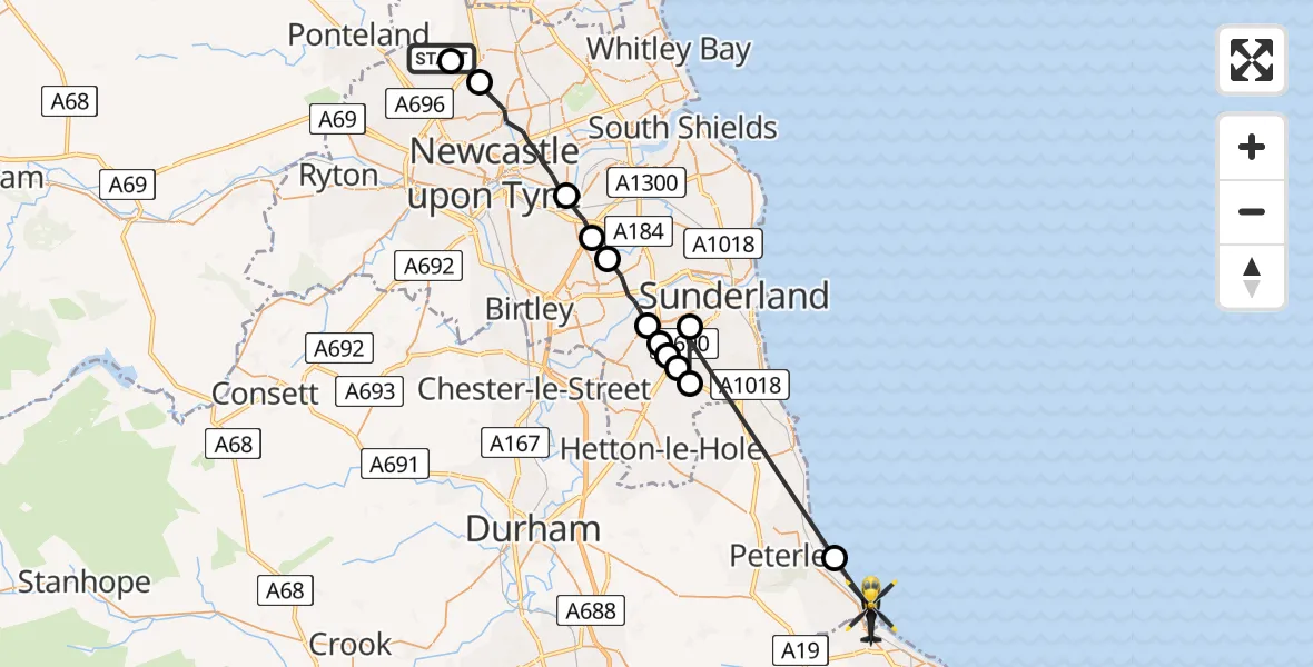
On Wednesday, 21 January 2026 at 11:35, a Police Helicopter departed from Newcastle upon Tyne to Hart. It was the Police Helicopter with registration number G-POLA. The flight lasted 14 minutes. During that period, the aircraft travelled 31 miles at an average speed of 134 miles per hour at a maximum altitude of 1700 feet.
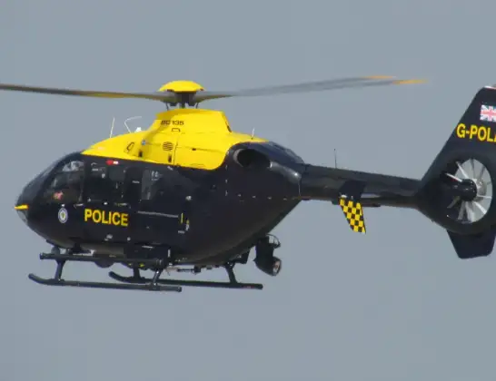
Helicopter: G-POLA
The helicopter G-POLA is used by the British police. The helicopter is deployed in pursuits, missing persons cases and other incidents where a helicopter provides added value.
Photo: ozz13x
32 miles
1700 feet
134 mph
14 minutes
11:35
11:49

Route
Hart to Haswell Walkway, Tees Valley11:49
Blackhall Colliery, North East11:48
Sunderland, North East11:43
New Herrington, Sunderland11:43
Houghton-le-Spring, Sunderland11:43
Sunderland, North East11:42
New Herrington, Sunderland11:42
Sunderland, North East11:42
Washington, Sunderland11:40
Gateshead, North East11:40
Pelaw, Gateshead11:39
Newcastle upon Tyne, North East11:36
Hazlerigg Village, Newcastle upon Tyne11:35
Newcastle upon Tyne, North East11:35
Today
Flights Hart
Air Ambulance Helicopter to Hart, A17920 Mar 15:31
Helicopter flights on your website?
You can easily display helicopter flights on your own website. Use the embed code.
