Police Helicopter to Swansea, Pontarddulais Road
Tuesday, 20 January 2026 | 23:30 | From Sigingstone
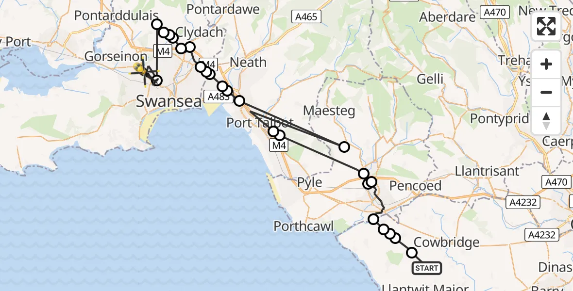
On Tuesday, 20 January 2026 at 23:30, a Police Helicopter departed from Sigingstone to Swansea. It was the Police Helicopter with registration number G-NWOI. The flight lasted 13 minutes. During that period, the aircraft travelled 53 miles at an average speed of 244 miles per hour at a maximum altitude of 2850 feet.
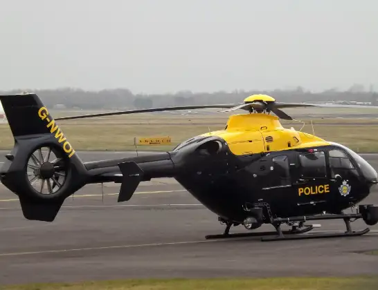
Helicopter: G-NWOI
The helicopter G-NWOI is used by the British police. The helicopter is deployed in pursuits, missing persons cases and other incidents where a helicopter provides added value.
Photo: James from Cheltenham
54 miles
2850 feet
244 mph
14 minutes
23:30
23:43

Route
Pontarddulais Road, 23:43
Swansea23:43
Felindre23:42
Swansea23:42
Mawr23:42
Craig-cefn-parc23:42
Swansea23:41
Ynystawe23:41
Tregof23:40
Swansea23:40
Coed Darcy23:40
Llandarcy23:39
Jersey Marine23:39
Briton Ferry23:39
Llangynwyd Middle23:38
Port Talbot23:37
Tai-Bach23:37
Aberkenfig23:36
Sarn23:36
Pen-y-fai23:36
Bridgend23:33
Corntown23:32
Ewenny23:32
Colwinston23:32
Llandow23:31
Sigingstone, 23:30
Today
Flights Swansea
Flights Sigingstone
Police Helicopter to Swansea, Pontarddulais Road20 Jan 23:30
Helicopter flights on your website?
You can easily display helicopter flights on your own website. Use the embed code.
